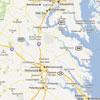
Geography and the environment remain important today. Looking the 1612 map of Virginia, we saw that John Smith and the Virginia Company investors were most interested in rivers as a means of travel and trade, and the presence of Virginia Indians. What might a historian determine about modern Virginia given this map from 2011?
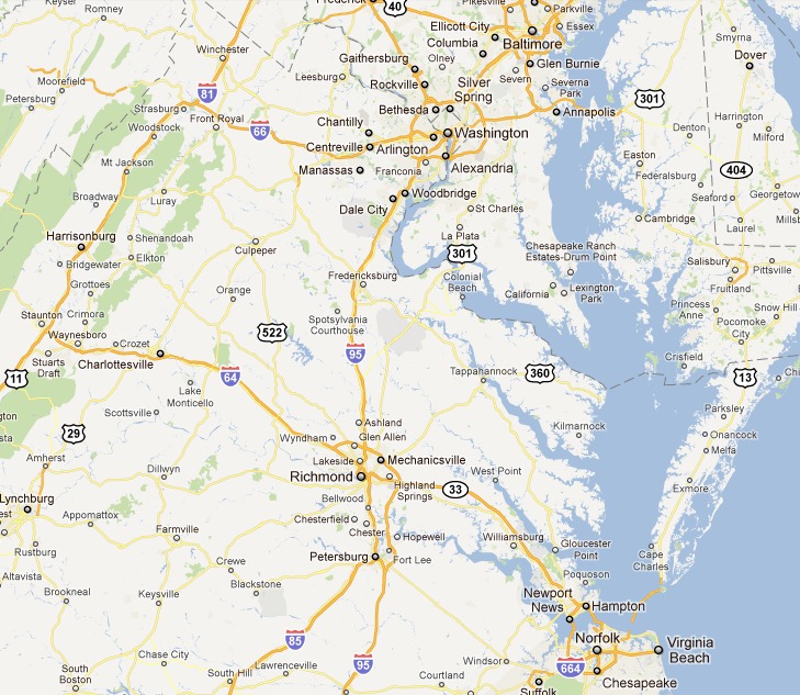
First of all, roads are now of vital interest to this map’s audience. There seem to be fewer towns than on the 1612 version – though we may know, from other sources, that this is simply because smaller towns are left off of this map – and they have very different names. This map also lacks any representation of the non-human environment. With the exception of a few natural areas visible at this level of detail, there are no indications of flora and fauna as there are on John Smith’s map.
What do these observations suggest about the creator and audience of this map? It suggests that this map is focused more on travel and perhaps trade or tourism than on natural resources. It also suggests that settlement might be more concentrated that it was in the past. Maps such as this one, especially used in conjunction with a historical map such as John Smith’s, can be a useful way to engage students with questions about both Virginia’s physical geography, and the ways in which people and environment interact and shape each other historically and today.
Source: “Virginia,” map, (Google Maps, 2011), accessed September 17, 2011.
Instructions
 |
 |
 |
 |
 |
 |
 |
 |
 |
 |
 |