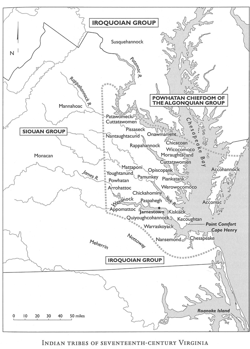
By the time the English landed at James Island in 1607, Powhatan’s paramount chiefdom covered 6,000 square miles and included an estimated 14,000 of the 20,000 Algonquian-speaking Virginia Indians. Many historians believe Powhatan consolidated the Algonquian-speaking districts, starting in the 1570s, in order to form a combined front against Iroquoian- and Siouan-speaking districts to the north, west, and south – as represented by this map.
By 1607, regional chiefs (male and female) controlled almost all of the Algonquin-speaking groups. Most of these leaders were subjects of (or strongly influenced by) the paramount chief (mamanatowic), Powhatan. John Smith learned from Powhatan that he inherited six districts from the previous mamanatowic. By this time, Virginia Indian groups had developed diverse and sophisticated cultural, political, economic, and technological systems. They practiced forms of agriculture and land management well suited to their environments, engaged in far-flung networks of trade and diplomacy, and had a rich history and belief structure.
Source: Helen C. Rountree, “Indian Tribes of Seventeenth-Century Virginia,” map, in Before and After Jamestown: Virginia’s Powhatans and Their Predecessors, by Helen C. Rountree and E. Randolph Turner III, 1st ed. (Gainesville: University Press of Florida, 2002).


