Virginia Geography
Virginia Geography - Wrapup
/
Virginia Geography - Classroom Connection
Elementary
As teachers we know all students learn differently according to their readiness, interest, and learning style. I love how Virginia's geography can be used again and again to revisit and build on prior knowledge to answer deeper questions about why particular events happened at a particular location. It is our job to create those aha moments where students make those connections and the pieces of the puzzle start creating the bigger picture.
Teacher
Elementary
I've spent a great deal of time this year submerged in the VA studies curriculum, but I feel like I have done my students a disservice by not investigating more maps and VA geography. Students need more time to make the significant connections to the role it played in the colonization of our state, why its so unique to the other 12 colonies from the start!
Virginia Geography
Middle
Geography is important to culture and everyday life. It influences how a society develops and what resources it has access to. Students can investigate various regions in Virginia, and analyze the regional geographic impact on various peoples.
Virginia Geography - Classroom Connections
Elementary
I have a different perspective on how to teach VS to my 4th grade students. Trying to get them to visualize the map, thinking about the environment the people were in, using pictures to get them to think critically about the time period, using the human interactions and the physical (geographical) reasons and locations will help them understand the history more. This is the first time I am learning this, and I am not from Virginia, but rather NY, and I don't know VS information, it is making me see it a little more clearly. I bet this would help my students if it is helping me. I am going into the Revolutionary War as soon as my students finish a test on VS4, moving into VS5 and I think showing them some of the geographic features of it may just help them to see the why it was important to the war and why the victor won the battles. Also, the human interactions and motivations will help them piece together more of the history as they learn it.
Geography in My Classroom
High
Geography has not been a central part of my classroom. Each summer when I reflect on the previous year and construct a wish list for the next it is always something I list yet one I often abandon in the rush to stay on pace. When I think of Geography the first ideas that come to mind are places and regions outside of Virginia. Students need to know a limited number of specific locations both in the US and abroad. Often those are taught like any other term or concept in our curriculum. This module has shown the importance of including the geography of the events and themes rather than treating geography as it's own learning goal. The use of it can provide students with a better understanding. I of course realize why certain Civil War battles occur at various places and why the strategy of the Union and Confederate armies were dictated by geography, but as I watched Dr. Ayers video I had to acknowledge that I have not discussed that in great detail in my Civil War unit. We certainly discuss the need for resources and how railroads played a part, most notably Sherman's neckties. But I will do a better job of incorporating the geography behind events into my own lessons. I thought the mention of how a knowledge of geography could have great impact on the success of a runaway slave or leading to the likelihood of their capture or even the deterrent from attempting. I appreciated the many benefits of focusing o geography were presented in this module and will incorporate them in my lessons. I especially liked how Dr. Ayers referred to it as a bit of a "from the ground up" approach.
Mapping Virginia
Elementary
I want my students to have maps of Virginia come alive for them. As we study an individual or an event I want them to complete mapping assignments showing the details of the person or event's location. I want the students to draw or use photographs of the natural resources of that location on the map as well as any dwellings or other structures. To know the importance that geography played in the history of Virginia will help them to also see the role that geography plays in our lives today and in the future of Virginia.
How our Virginia Changed
Elementary
This unit has presented many different ways of looking at Virginia throughout history. Even in elementary grades, I think students could learn by observing maps and photographs of specific time periods in order to compare them and see how things changed. I would use these maps to have students look at the way people settled close to water sources and how human development was impacted by transportation, economics and agriculture from there. This would also be helpful for students learning about the fall line and how that impacted development in the early years of settlement and growth in our state. Ideally, students would draw conclusions on their own based on what they see in their investigations, but it could also help them understand when this content is taught more directly.
Virginia Geography in the Classroom
Elementary
We use maps in the classroom quite frequently. I will start using more photographs/videos that depict the characteristics of each geographic region and the important places that lie within. As we talk about what has happened in history, we can get a better look at where it happened in order to understand why it happened. Being able to see the natural landscape, as well as the cultural landscape, will make some events easier for students to understand.
This Land is Our Land
Elementary
Tell students to think about playing hide and seek. Ask them if it would be better for them to play at their house or a friends house. Ask them to give examples and details why one or the other would be easier to hide and not be found. Explain this is what it may have been like for a slave trying to escape. If he/she knew their surroundings and the geography of the land, it might be easier for them to hide and escape.
Another activity would be at ask students to give reasons why it may or may not be better to have your house on a hill. Let them brainstorm the reasons and share. Get them thinking about the geography of the land and how it is beneficial.
Another activity would be at ask students to give reasons why it may or may not be better to have your house on a hill. Let them brainstorm the reasons and share. Get them thinking about the geography of the land and how it is beneficial.
Mathematics Teacher
Middle
Being that I teach Algebra, it would be challenging to put this in a lesson, but a simple research mini-project may be a good idea to implement the history of VA.'s geography. The main focuses on the research topics would be Va.'s environments and cultural landscapes, geographical movement, and human geography within different regions. I want them to understand that geography helps their understanding of VA.'s history, and understanding the history of VA. will only allow them to see things more clearly for themselves, not from what someone told them.
4th Grade Teacher
Elementary
I will implement more geography in my classroom by using primary sources including maps and books to teach. This will be helpful when teaching VS. 2 in the beginning of the school year. I will have students look closely and maps and study what the geography can teach us about the past.
Classroom Connections
Elementary
I would take a google Earth tour of Mt. Vernon. I would have students look for key geographic features. Students would then compare what they see to other regions in the United States. They would look to see if they can spot any regions that were used for farming.
Teacher
Elementary
I will definitely use the information about the Chesapeake Bay and the oysters to help students draw conclusions about human impact on our Earth.
Virginia Geography in the Classroom
High
Prior to getting into the Revolutionary War, or the Civil War depending on grade level and subject I would introduce a Virginia Studies/ Geography unit. This would help students be able to make true connections to these events. Local battles such as Battle of New Market during the Civil War and talking about the geography of these locations and why specific battle sites were chose by the Union would have a profound effect on students. In Virginia especially many sites were chose due to their geographic importance. A great activity would be to have students research several battles and discuss if it were to happen in a different place if the outcome of the battle would have been different. What impact did the geography have on the overall outcome? This could be done as a whole class discussion, small group discussion or even small group presentations depending on grade level and content.
Through Washington's Eyes
Middle
I, too, have had the pleasure and privilege of experiencing the cupola view at Mount Vernon. I never really imagined George Washington up there because of his stature. It’s not a very large area and only 2-3 people can squeeze up there at a time. In the summertime, it is hot and in the winter time, it is cold. My point is to change perspectives, to look at the waters and lands from multiple perspectives. In reading the previous essay on Mount Vernon, it mentioned that “The relationships go both ways: physical geography influences (but does not determine) how we live our lives, and our lives transform the physical environment. It eventually becomes hard to separate the physical from the cultural.” I will be rephrasing my phrase “Where you live, determines how you live.” I understand that it doesn’t necessarily determine HOW you live because there are other factors and people control so much of the environment and landscape. I believe that I will be making that change and discussing more of the relationship between geography and history. By studying Washington, I have learned that he has many perspectives that can be used to examine geography at least up to 1799. He knew the land from his childhood and job as a surveyor. The knowledge of the land that he gained from the French and Indian War and American Revolutionary War was no doubt important. He looks at the land in so many ways for so many uses over time. He was well known for documenting his farms in great detail with fencing, plants, livestock, fishing, and more. He writes in journals what the enslaved people were doing on which farm, and how they were tending the land. I just recently learned of his visit at Berkeley Springs in West Virginia and his visit to the Natural Bridge. How did Washington use geography in his favor over his lifetime? I can’t say that I use geography as an advantage in my life or don’t really think about it as he obviously did. It would be interesting to “connect the dots” of Washington’s life and discuss the impact geography had on his decisions. Sure, he made mistakes in his lifetime but he wasn’t perfect, but looking through his eyes may give us a better understanding of the past.
SPED Teacher
Elementary
I will make sure to explain to students how the environment affects how people lived in the past and how we still use geography now to go for either work or entertainment.
Spencer Billett
High
I could apply this lesson to the classroom in a lot of different ways. One of the major AP themes is the interaction between humans and the environment. I like that we could focus specifically on the images that showcase the small ways that humans utilize their environment. The map from John Smith can show from the very beginning of colonization there has been a desire to focus on ways that people can profit from the physical geography of a place. I mentioned in previous answer that I like to have students debate the concept of "geographic determinism," or the idea that as humans we are bound by where we live, or can we alter the landscape ourselves and escape the "destiny" of a particular geography.
I live and teach near Richmond, so the Tredegar Iron Works photo is very interesting, I did not know that it pulled its power from the James. Hopefully this can prompt myself and other students to think about the physical environment all around us and how it has impacted history. The section on the Civil War from the UVA professor was also very interesting and can be used in the classroom.
Having students analyze and dissect different maps and photos would be a good activity to have students think critically about how humans have changed the landscape. For example, I could easily overlay the map of John Smith with the modern road map, and have students write about what these transformations mean for Virginian history.
Fourth Grade Geography Connection
Elementary
While learning about how Virginia’s history and culture develops after the European settlers arrive, bringing a little geography into every lesson is important. Seeing how the rivers have been used for hundreds of years by the Native Indians, and how they are still used today is an important part of getting the whole picture. For this geography connection, I will have my students look at where pivotal Civil War battles took place and they will have to connect the important role that geography played in winning or losing that battle. For example, the Battle of Bull Run. The high ground gave an advantage and the proximity to DC was also significant. The battle of Great Bridge was also greatly impacted by the geography at the time because soldiers were trapped by the river and the bridge. Showing students not only historical illustrations of the battle, but showing them the physical geography of the land might spark greater historical context and understanding. They would work in small groups or partners to come up with their conclusions, then we would debrief as a whole class at the end.
4th Grade Teacher- Pertl
Elementary
I already apply Virginia Geography to my classroom because it is the first unit that the students learn. However, I do think I need to focus specifically on geography more for each unit after. I often bring up to the students, "this is why we learned about Virginia's geography first. Because if you do not know where this river is, you would have no idea what we are talking about here." They will say, "oh, I understand now!" However, I don't purely focus on the geography impacting things like the America Revolution and the Civil War, so I think I will start building into my lessons a focus on the geography of certain places impacting those as an example.
Teacher
High
I would have my students use something such as google maps to look up and find their own house or neighborhood. Then have them describe and tell me what they can conclude from looking at their own neighborhoods. From there I would have them branch out and look at other states and see what they can conclude about other places they are looking at.
Exploring Colonization and Cultural Landscapes - Jamestown
Elementary
Begin by reviewing what cultural landscape is. What types of structures are we talking about when we consider cultural landscape? How does cultural landscape change geographical area? Explain that we will be examining maps prior to and after the arrival of colonists to determine if there was any geographical change affected by cultural landscape. Have students divide into partner or small groups to examine maps and consider questions presented.
Give students maps of the Jamestown area prior to the arrival of the colonists (ex: map made by John Smith, etc.) What do we see? What types of things are indicated or highlighted on the maps as important? Where are the placement of settlements of native peoples? What do we know about the structures that native peoples built? What was their relationship to the land and what materials did they use to build their structures? Is there any geographical importance to the location of native people settlements?
Give students maps of the same area after the arrival of the colonists (ex: maps from John Smith, maps of Jamestown colony, etc). What do we see? What types of things are indicated or highlighted as important? Are these things similar to or different than those that were indicated or highlight as important prior to the colonist arrival? What do we know about the structures that the colonists built? What was their relationship to the land and what materials did they use to build their structures? How was it similar to or different from the relationship and materials of the native peoples? Do we think that geographical weather differences from that of England have any impact on how they built their structures? Is there any geographical importance to the location they chose for the Jamestown settlement?
After examining the maps and considering the questions presented, have students meet back together as a class to share and discuss their findings.
The Relevance of Geography
High
The way that I will apply teaching about Virginia geography in my classroom will be through the use of primary source investigation. Following the example given with the page on the regional names and differences of them in Virginia. I would then have the students investigate deeper in to those differences and how they have influenced the socioeconomic and political decisions of the residents of these regions.
5th Grade VA Studies
Elementary
I would align the geography standards with the standards being covered for students to discover the significance of the geography of Virginia and it's role during important events in history.
Teacher
Elementary
I've learned that I can tie in geography with other categories of social studies. For example, when teaching famous Virginians like Pocahontas, Christopher Newport, and Powhatan, I can talk about the geography and landscape of Virginia. With that background knowledge students can form conclusions and take learning a step further.
Virginia Geography
Elementary
At the beginning of the year, we learned about Virginia's Geography. I think I can apply what I have learned to my classroom by using the foundation students get at the beginning of the year to help them better understand and more critically think about topics the rest of the year. For example, we will soon be learning about the Civil War. One of the videos on the resource page talked about getting students to understand the landscape first to help them understand the Civil War. That is something that can definitely be applied to my classroom.
Using Historical and Modern Day Maps
Elementary
I would like to use modern day maps in conjunction with historical maps to engage students with questions about both Virginia's physical geography and the ways in which people and environment interact and shape each other historically and today.
Social Studies Teacher
High
I can apply Virginia Geography in my classroom to teach military conflicts, such as the American Revolution and the Civil War. Using the concept of geography, I can help students understand that battles were fought in very specific locations and why they were fought there. Whether it was a railroad junction or a strategic river, town, or city, battles were fought in particular locations to help armies gain control over key areas, enabling them to emerge victorious in these conflicts. The emphasis of geography can also be used to explain why certain battles were fought they way they were fought i.e. the focus on controlling the "high ground" at Cemetery Ridge at the Battle of Gettysburg.
I can use geography when teaching Colonial Virginia. I can use geography to show and explain to students why Virginia looks the way it does today. Geography played a critical role in explaining why cities and towns were established where they were. Geography also played a role in the development of Virginia agriculture and eventually industry, particularly where in the state and what was cultivated and created.
Beginning with geography, students can achieve a better understanding of history by getting the "big picture" and looking at history from a different perspective. Using and emphasizing geography and its impact on historical events helps us as teachers focus more on the "how" and "why" as opposed to near exclusively the "who," "where," and "when."
Teacher
Elementary
We study geography mostly by itself at the beginning of the school year and students learn about the regions, rivers, landforms, large bodies of water in Virginia. But throughout the year, we are constantly going back to geography as students learn historical events that have a large part to do with physical geography. For instance, the location of Jamestown was placed because of physical geography, and eventually the capital was moved twice for the same reason- because of physical geography. Battles in wars- Yorktown, Fredericksburg, have significant issues and results due in large part to physical geography. The movement of settlers farther west/Cumberland Gap, development of slave states, all have reasons for happening relating to physical geography. So therefore, concepts learned at the beginning of the year regarding geographical knowledge must constantly be referred back to and added to as the year progresses and historical content is added.
Virginia Geography in the Classroom
Middle
I can apply the utilization of Virginia's geography, other states, and countries when teaching both Civics and Economics. Our school is close to waterways such as the Rappahannock River, Piankatank River, York River, and Dragon Run. We are on the Middle Peninsula of Virginia where agriculture and the Chesapeake Bay are part of everyday life. Students can research the history of our community and the human-environment interaction especially with regards to the Chesapeake Bay. Understanding them could help them engage more with citizens of Middlesex County and also increase involvement in the community. When teaching economics, the geography of Virginia will help students to understand the history of Virginia's economy and the relationships it has with trading partners both nationally and internationally.
Geography
Elementary
When looking at maps, I will challenge my students by having them consider why certain areas were more populated than others. I will explain to my students how environmental factors and landscape can affect human activity from where people decide to settle to the location of Civil War battles.
Teacher - US History
High
I would have students look at different maps created in different time periods to see what kind of features are important to the people of that time period-- what do they put on the map, and what do they leave off? What does that tell you about the way that people of that time period lived?
Virginia Geography in the the Kindergarten Classroom
Elementary
I think its important that Kindergarten students understand that the Virginia they live in, is the Virginia that has been here for for centuries. Important people lived here and shaped the landscape. When discussing these important people, they should know the impact they had on Virginia. They should also know that they are just people, people who lived here and worked the land, made important decisions to form the Virginia we live in today. There are still places we can visit, whether in person or through pictures, that show how Virginia was in the past versus what it looks like now.
Geography Connection
Elementary
Based on the 5th grade currculum (Ancient Civilizations) that I teach, before we get into the history of an ancient civilization (Mesopotamians, Egyptians, Indians, Greeks, Romans, and Mesoamericans) we first do a lesson on the geography of that ancient civilization. We examine the physical geography of each civilization and how the physical features that surround that ancient civilization impacts it's success. I make those same connections to the 4th grade curriculum (Virginia History) that they learned in the previous year. Example, the importance of a river--used for a source of food, trade, and transportation. Both colonial Virginians and Mesopotamians used rives for the same purpose, even though these groups of people are separate by thousands of years.
Geography in the Classroom
Elementary
I have already incorporated geography into our lessons in the classroom. I utilize different maps as a tool to help students understand the area that is being studied, the time period that is being studied and also the role that the land plays in what they eat, how they live, the kinds of jobs they have, etc.
Settlement Patterns
High
I will have students compare a physical map of the state of Virginia, and population density maps of the state, over time. I want students to see the physical reasons why people settled in the eastern part of the state first, obviously, but also how the geography makes settlement easier there, and has allowed for the major population growth in those areas, as compared to the western part of the state.
3rd Grade social Studies
Elementary
Having students think about geography helps students understand the why of certain events. While in 3rd grade we do ancient civilizations and not VA studies, the concept is the same. How does the land play a role in society, architecture, jobs, etc? The James river and the Nile are both vital to history of the area. Starting a new unit with geography would be a great way to introduce the unit and build background.
Virginia Geography
Middle
I think it would be interesting for students to find the connections between Virginia's geography and compare it to the location of the battles during the American Revolution and the Civil War. Also, I think it would interesting to compare the geography to the population and economics centers of our state today.
“Don’t Fence Me In”
High
I would share Robert Frost’s poem “Mending Walls” with my students about neighbors repairing a stone wall (fence) between their properties. We would then examine the history of fence building in America. We would discuss the first fencing law in Virginia, created in 1631, and that its purpose was to fence livestock out rather than in. Fences were a phenomenon brought about by settlers to this country; Native Americans had no need of fences. The colonists’ need for fencing was to establish ownership and boundaries, and to keep other people’s animals out of their crops. We would continue to look at how fencing has changed throughout our history and determine it’s important today in our culture.
The Purpose of Geography
Elementary
The geography module gave me a different perspective on how to introduce the 5 Geographic Regions to students. By using different types of maps while teaching certain topics, I will be able to provide information on historical figures, their contribution to history and how their actions affected the future.
Geography in Elementary Classroom
Elementary
Teaching 4th Grade Virginia Studies I love showing my students the videos made by the Virginia Trekkers. This gives my students a "virtual" type field trip through their videos. I will continue to show these videos to my students but I will use what I have learned about Geography in this unit and have my students look deeper at some of the places we look at in the videos. For example, one of the videos we watch is the Great Dismal Swamp while we watch the video I will have students look at different maps like the one from this lesson and then discuss what the map and the video taught us about the Dismal Swamp.
Art Teacher
High
Over 60 artisits have depcited the Natural Bridge. Students will look at several different paintings of the Natural Bridge. They will compare and contrast the differences between the paintings and will notice the dates of the paintings. We will then look at other landscape artists from the five regions of VA and see how the environment effects their paintings.
The Jamestown Colony
Elementary
I will definitely be using maps as primary sources to help students understand the importance of not only agriculture but the importance of the rivers that they learn about in Geography. Students can look at and compare maps from the past and future to find areas where resources such as oysters, tobacco, livestock, and cotton were planted and why they were harvested in that region.
Geography in the Classroom
Elementary
I can connect Virginia's geography to historical events and show my students how it impacted decisions made. For instance, I can show them why battles in the Civil War were fought where they were. This will make the history more relatable. I can also show them why cities were settled where they were. Showing them maps from that time period as well as comparing them to maps from today will give them a better understanding of what life might have been like back then. Having a basic grasp of Virginia geography is great, but if they can understand the impact it had on decisions made in history, they may feel more connected to it.
Geographical tour around Virginia
Elementary
Google Earth allows you to create tours, save them, annotate them, and then share them. It would be interesting for students to create a tour of important locations around Virginia where they see the human-nature interactions, explaining how those interactions shaped the land and actions there. Why did people choose to settle or farm there? What are the natural features and resources? What is nearby? How does this place relate to Virginia history?
Mod 2 Response
High
Before Covid 19, I used to take students on a field trip to the Holocaust Museum and a monument tour in D.C. If I ever get to do that again, I might add a geographical study to the trip. Analyzing the differences between the Shenandoah Valley and D.C. might interest some students. Maybe they could think in terms of Civil War troop movements.
Places and the Narratives
High
As I work through this module what comes to mind is the way that individual geographic sites, whether they are generalized, such as a view of a fence around an unnamed plot of land, or specific, such as Mt. Vernon, are springboards to a variety of narratives/stories. In other words, geographic sites can be applied to a classroom by asking students to consider the multiple different perspectives that various Virginians would have in relation to a specific site/place. Students could then share those different narratives, in a variety of formats. For example, during the course of a lesson/unit about life in colonial VA, a teacher could share the "fence" image and ask his/her students to consider how: a) an enslaved Virginian might've felt about that fence; or, b) John Rolfe might've felt about that fence; or, c) how a Native American might've felt about that fence; or, d) how the wife of a European settler might've felt about that fence. In short, the stories and perspectives on the past can radiate from a single site so that students are able to not only gain a better understanding of the diverse experiences that existed in colonial Virginia but so that they also could strengthen their historical thinking skills, particularly those relating to causation and empathy.
Melinda A. - Music
Elementary
I can include songs that have been created by others about the different regions of Virginia into our lessons. Music can help the retention of facts of the different areas of our state. I could also encourage students to use information on the different areas, geographically, population, and overall make up of each area, to compose their own songs and presentations.
Virginia Geography
Elementary
This was very fascinating to me. Virginia has such a diverse geography depending on where you are. It's amazing how different it can be in the mountains compared to the coast. I've learned how much this geography contributed to where people decided to settle a long time ago. Washington chose such a beautiful yet beneficial and profitable place to live in Mt. Vernon. I would apply this new insight into my teaching by always going back to the map of Virginia when learning about a new historian or event and talking about why they were in that location and what were the benefits of them being in that specific place to what they were trying to accomplish. We would use the topography map regularly to constantly go back to, to evaluate. Also, look at how the map/population density has changed over time.
Geography
High
I will apply this in my classroom when covering the early colonies (Jamestown) and the Civil War. We can learn much about how the early settlers lived by studying the geography of early Virginia and how it forced the settlers to adapt the new world. It can also tell us much about the Civil War, and why so many battles were fought in the state of Virginia.
Historical Geography
Middle
I would incorporate more maps and discussions of geographic features and natural resources of the different regions of Virginia.
Geography in the Classroom
Elementary
As I worked my way through this module, I found myself more excited about letting kids truly delve into maps. I really like the idea of encouraging them to question the things that are included. This allows them to develop their own ideas about an area: why it's important, why it developed where it did, and how it helped towns and cities grow. In my own classroom, I'd like to give students more opportunities to study images and maps of the places we study. It would make a good opening activity for new units of study because it will get them engaged and thinking about how people lived and interacted with the land and others around them. I think it will give them a deeper understanding of why historical events occur where they do and why certain areas were able to grow and flourish better than others.
Geography 4th Grade
Elementary
I would love to apply a lot of the things I just learned into classroom. I think one idea that I would like to apply to the classroom is the examination of geography and the Civil War. Listening to the video about how the geography of Virginia played such a major role in the battles of the Civil War helped the battles of the Civil War make more sense to me. I would like to help my students better understand WHY the battles took place where they did, rather than just stating that there was a battle, here is where it is, and this is when it happened. I think exploring the WHY behind the battle through exploring the geography will help my students make connections and help them better understand the Civil War.
A lot depends on geography
Middle
Colonist were certainly limited in their expansion by not only Native Americans but also the geography of the terrain. Geography also dictated what crops to grow and where they could be grown, where to build, what to build with. Where work would eventually be located, transportation of goods and services. Even where the capital would be located. Geography essentially had its hands in everyday life.
Virginia Geography
Elementary
When field trips are advised again, I plan to take my fourth grade class to either Red Hill or Monticello. Before the trip, we will look at maps and pictures of the landscape. This would include the waterways, elevation, and how either Patrick Henry or Thomas Jefferson used the land to create working farms. We would discover how materials around the geography was used or how materials from Europe ended up in the homes. Discussions would involve how towns around these areas formed near rivers and eventually railroad crossings. After background knowledge and questions were formulated, we would take a field trip to the destination to see firsthand the experiences that humans had with the geography. Once we have returned, we would continue to explore the regions virtually to discuss the changes in geography and the effects they had on the cultural landscape, from the Coastal Plain to the Appalachian Plateau.
Location, Location, Location
High
I see this being a lesson or activity in my room, that could be used to teach about the 13 colonies in a US History classroom (Middle or High School) I see this lesson being one in which students looks at a Varity of maps (Climate, Elevation, Soil, Topographic and others) they would use these maps to help make opinions about the conditions for agricultural (I would supply a list of crops that were planted here in the 13 colonies and they would have to research growing conditions and climates needed for each) They would then decided where would be best for each to be planted and if these colonies could make an economy off it... as well I would do the same for other type of products that were used in the colonies (Fishing, lumber and such...) they would work in groups to figure our geographically where these should or should not be the main staples and then if they figure out that these areas could not survived on agriculture alone what other ventures might these colonies venture into to make money and become economically sustainable. (I feel I have more to add to make this lesson complete but I think that this could be a very interesting project if time would allow)
Library: Geography
Elementary
When I was teaching the students about Jamestown, I showed the students primary source maps of 1607 when the Susan Constant arrived to the Virginia colony. I compared that primary source map to one with Native Americans on it and different images shown on the map of Virginia. We discussed the different geography shown on each map with the students. We did they see on the land (rivers, ships, trees). We also discussed what images did they see on the maps (ships, compass rose, Native Americans, Chief Powhatan).
Five Themes of Geography
High
Teaching the themes of geography to students it is helpful for students to visualize through images. I provide students notes and diagrams of the themes. As a concluding activity then I provide students with images to match with the themes. Images are a window into the past.
Perspectives
High
When students look at the area that they live in, they will compare a map of the region from the past to the present. Then they will explain how it changed and why.
US History /World History
High
I enjoy teaching students about Manorial-ism. My students will have create his or her Manor and surroundings. I use old maps of manors to assist the students with developing well thought out manor in order to survive the environment and foreign invaders.
Virginia Geography
Middle
I will use Virginia Geography to connect the food sources, house material, and farming adaptations of settlers to where they settled in Virginia.
Virginia Geography in High School
High
One interesting idea I have was about voting. Before the modern era, voting was difficult. Especially when it had to be done in person only. It would be interesting to see voting history across the state. Where were most of the voters from? Did geography play a role (places with small farms, large plantations) in voter turnout? Did rural area in the mountains of SW VA has lower voting turnout? These would all be interest questions to look at.
Utilizing Primary Sources, Making Pictures, Brainstorming, Eliciting Information, Research
Elementary
This is the perfect teachable moment to teach geography and unlock previously taught concepts of primary sources, such as maps or globes. For very young kids, I probably will direct the students to draw neighborhood or county, draw their favorite park, natural scenic spot, or vacation and/or camping spot. I will utilize fun springboard activities that will elicit or take them to talk about Virginia's natural landscapes, geography, and natural resources.
I will also utilize primary sources, such as the map that John Smith drew himself that very long time ago where John Smith undeniably gave the Chesapeake Bay the ultimate prominence by placing it at the center of the map. We can use role-play where the students get to play the role of John Smith and talk about the map that he made.
For older kids, we try using the globe to pinpoint the geography of Virginia and exploit its characteristics. We could also utilize the research approach and find the oldest maps ever made of Virginia and compare and contrast those to more contemporary maps, and ask ourselves, "what have changed (if at all)?"
I will lead the students to discuss the values of a place's geography and resources. We will brainstorm together what might be considered advantages and disadvantages of Virginia's topography during a time of war. Or more simply, elicit the attractions why someone might want to settle or live in Virginia, or establish a business, and if its affirmative, what type of business might an individual establish in Virginia.
And inasmuch as there are advantages to almost everything, I will also prompt the students to talk about the disadvantages of Virginia's geography and resources (what things are lacking) as well in order to out the discussions in perspecctive..
Virginia Geography in the Classroom
Elementary
Allowing the students to visualize and put themselves in the moment... The use of pictures, maps, visual representations of how it all worked for the early inhabitants of Virginia. Understanding on how the geography of Virginia enabled early settlers to travel, live and affect their lifestyles.
History is Alive
Elementary
History is not just facts and figures about old, dead people. It can be a living thing that allows children to see what is in front of them with a different lens and perspective.
Geography in the classroom
Elementary
Looking at the influences on geography overtime will be a benefit to the students. People's cultures, traditions, customs and beliefs all play a role in what we see across VA. Bringing in sources to show how Virginians in history reacted to and impacted their environment will increase their understanding of our state and other places as they increase their knowledge. Virtually visiting Jamestown, Yorktown, or other historical sites, we can observe the impact those had on their environment and draw conclusions and create more questions about what Virginia was like in the past.
Chesapeake Bay
Elementary
We do a unit on the Chesapeake Bay. I think it would be interesting to compare the geography of the Chesapeake Bay in two different eras. I would have the students use the State of the Bay reports to research and see how the geography of the Bay has changed over time. What was important to us then, and now? What efforts were made to preserve the Bay and reduce the alteration of the geography. I think this would be a great partner activity or group presentation, allowing students to choose their role of participation.
How Geography has effected Virginia History
Elementary
We will break into groups of three or four researching how water has effected the Virgina history. Each group will be assigned a different body of water to share their findings with the class.
Teacher
Elementary
When studying the regions of Virginia in the beginning of the year, I would present images like this one of the various different regions and have students make hypotheses about each image. What they think they see and where these images were taken.
KaitlynC
High
I would use the changes in the maps to teach how the arrival of colonizers changed the landscape of the land and the way of life for the Native people.
Virginia Geogrpahy
Middle
I will take the John Smith map and have students investigate the map. As a class, we will write down our findings.
I will take a map from the mid 1800s and have students investigate the map. As a class, we will write down our findings.
I will take a current map of Virginia and have students investigate the map. As a class, we will write down our findings.
Students will then have the opportunity to look at the three maps. The class will see if they can find any similarities between the three maps.
Fourth Grade Lesson
Elementary
I would start by showing the students John Smith's map of Virginia and have them make observations. Then I would show the students a current map of Virginia and have them make observations. Finally, I would have the students use their observations to complete a Venn Diagram comparing and contrasting the maps.
Teacher
Elementary
Although I remember learning geography in elementary school as a kid, and we teach it first in most units, I have never really made many connections to the landscape a geography of a place with it's history. In all reality, geography is where it all first begins. I will ensure that instead of blindly teaching/learning the basic aspects of a space, to include how the landscape impacts the decisions made that create history. For example, teaching students why battles took place in certain areas, not just that they did will have a much more meaningful impact on their understanding of it. Teaching students how coal mining created a social gap between classes will help connect geography to cultural learning. In an essence, I will no longer teach a simple unit of what the overall landscape of Virginia looks like and then move on. I will continue to infuse it and use what we've previously learned to connect with other areas of Virginia Studies.
Western Expansion
Elementary
using maps to show the area then and now ( Virginia, the US). compare the geographic land, plants, animals , population in the east and what the west looked like. Discuss the Oregon trail , Chisolm Trail, , boats vs covered wagons, If travel by water kept people originally kept people in the east. Why and how was the travel west different. We could make history come alive by relive what our country was like by this discussion. Activities such as making butter, sampling buffalo stew, sewing a small quilt pattern by hand, Use a calendar to figure out many days it would take them to travel by land or water to go for a set number of miles. Videos or clips from several old movies showing people traveling by covered wagon or by water.
Western Expansion
Elementary
using maps to show the area then and now ( Virginia, the US). compare the geographic land, plants, animals , population in the east and what the west looked like. Discuss the Oregon trail , Chisolm Trail, , boats vs covered wagons, If travel by water kept people originally kept people in the east. Why and how was the travel west different.
Virginia Geography
K-12
I love maps! I think just by doing some surface level analysis of a map you can begin to make a lot of educated guesses about the culture of the people living there. This module helps me to think about what other primary sources can accompany maps to help students better understand human-environment interactions. For example, the simple picture of the fence raised a lot of questions about how humans interacted with their environment. Including pictures and text sources that provide insight into the landscape of a place, alongside maps to create primary source sets, can help students gain a more complete understanding of how geography influenced human decision-making. Those sources can also help students confirm or reframe the hypotheses they made from looking at the map alone.
I would also like to encourage more opportunities for student field trips. When students can stand in a place and see the lay of the land from the same perspective of those that once stood there, it helps them to experience that connection between the physical landscape and its influence on decisions-making. For example, understanding how a military battle unfolded and how the topography directly impacted battle plans.
I would also like to encourage more opportunities for student field trips. When students can stand in a place and see the lay of the land from the same perspective of those that once stood there, it helps them to experience that connection between the physical landscape and its influence on decisions-making. For example, understanding how a military battle unfolded and how the topography directly impacted battle plans.
4th grade
Elementary
Having students really experience the geography of Virginia helps them to truly understand it and its impact on our history. For each of Virginia's regions I will have students take a Virtual trip to the land in that area using google earth and other web sites. I will have them conduct virtual field work to better understand the geography of each region and its impact on the people who live there both past and present.
4th Grade Teacher
Elementary
Currently, teachers in my district are encouraged to teach students about each individual region and emphasize the economic focus of each. We don't really spend time discussing how the geography influenced the establishment of the English settlements, or how the Native Americans inhabited the area. So, in the future, I'd like to put much more emphasis on the geographical layout of Native Americans, the density of their culture throughout early Virginia, how John Smith developed his map and what he chose to focus on, as well as, how geographical features effected the life of early Virginians.
Create A Country Project
Middle
Students will be tasked in groups to create a country from the ground up on a made up continent designed by the teacher. This continent will feature all of the major geographical features discussed in geography units and one portion of the project will ask students to design a map of their new country. Part of this map will be to identify geographical features and determine where cities and towns along with major roads, highways, and bridges may be placed. The various geographical features will also help determine what resources might be produced and how, further engaging the students in human-environment interactions. Students will also be given various wildlife to place in their various geographical features. How students develop a country based on the geography of their given country will be one aspect of their final grade in the project.
The Louisiana Purchase
High
Provide students with maps of the Louisiana Territory. Instruct students to retrace the routes of Lewis and Clarke, identifying water routes, plants, wildlife and Native American groups encountered along the way.
Ms. McCrary 5th grade teacher
Elementary
I will teach more of a fundamental vocabulary to start off with so the students actually understand what is going on once we move into the the nitty gritty of VA History and why the Eastern part of the state is so important.
VA Geography
High
I think if I did a Virginia craft unit, I could teach the students about how the different Geography created the need for different crafts in different areas, What someone in the Virginia Beach area would create versus someone in the Roanoke area would be very different. I could also tie it into an architecture unit, how different areas of Virginia have different building materials, and different weather, and how that would affect buildings in that area.
Geographic History of Virginia
High
The way that Virginia was taught I can see myself using that to talk about various subjects in World History 1 and 2 from discussing Athens and Sparta in World History 1 to the Industrial Revolution in World History 2. I can use the physical geography to discuss why the Industrial Revolution began in Great Britain as well as looking at human geography how we impacted the environment during the Industrial Revolution. When looking at Athens and Sparta having the students take that geographical walk from Athens to Sparta documenting the landscape along their journey.
Adding Geography
High
After reading this section, I am going to add more of a focus on the geography within the information that is presented for the classes. In our district, geography has not been a major focus, but I think with the addition of how geography has played a role in the events that have shaped events in history of Virginia. I like the idea of creating more lessons that incorporate geography in their lessons.
SPED Teacher
Middle
I learned so much about Virginia's Geography in this lesson. Reading about how all the different regions offer a diverse yet similar way of life. I like the idea of giving students a copy of two different maps of the same area and having them see the differences and similarities. Having them ask the whys.
I also like tying what they learn in science about the Chesapeake Bay and how it has involved/suffered since its discovery. They would do this by studying physical maps from John Smith and using the internet to see and read current maps and articles.
I also like tying what they learn in science about the Chesapeake Bay and how it has involved/suffered since its discovery. They would do this by studying physical maps from John Smith and using the internet to see and read current maps and articles.
Ele. Geography.
Elementary
Many of the standards in Virginia Studies (4th grade) already have geography components to them. We be sure to include many pictures to go with the notes, and be sure we talk about how it is different today, and how the world around them affected their lives.
Geography's role in history
Middle
Physical geography helps explain why certain events and structures exist where they do. Maps can provide not just physical geographical information but can also include other features depending on the purpose. The land reflects the impact of human development just as the land shapes and limits human actions.
Virginia Geography and Virginia History
Middle
To study VA history, students would need to have visuals-maps-so they can see how the geography of the land influenced the development of settlements. Students can follow the riverways and see why these created hubs where travelers would come to settle and where farmers and tradespeople came to do business. Students can analyze a variety of maps created over Virginia's history to help them understand Jamestown, settlement, creating of cities, and key events in the civil war. I would give students the opportunity to learn the connection between geography and history by having them ask and answer these questions when reading about an event: How did the environment impact this event? Could this event have happened anywhere else in Virginia? Why did this event happen here?
Teacher
Elementary
One thing I can do in my classroom is to have students compare/contrast different geographical maps of Virginia and how the maps have changed through the years. After discussion, I could then have students work in small groups to create their own map about what they have learned. Another thing that I could do is to visit Monticello and Mt. Vernon virtually. As a class we could do a virtual field trip of both and then compare/contrast the geographical features of both locations.
Virginia's Rivers: The Interstates and Internet of the Civil War
High
Throughout this module we were forced to really think about the intersection of physical and human geography and how the diverse physical geography of Virginia has shaped historical events in the Old Dominion. At the beginning of the module, the split rail fence symbolized this theme of human-environmental interactions and how humans have shaped the natural environment to meet economic, cultural, and even military needs.
As I reflected on Virginia's geography, I thought about Richmond's role in the Civil War, as the manufacturing, transportation, and political hub of the upper Confederacy, and more generally the role of Virginia's numerous rivers in the Civil War. The Potomac, James, Rappahannock, and York Rivers were all key to military success for both Armies. I envision planning a lesson, based on primary sources such as 1860's maps and reports of troop movements from both Armies, along with timelines and results of battles, to explore how Virginia's rivers played a key role in the outcome of Civil War battles. I am always looking for connections to the present when developing new lessons, and think it would be a great addition to this activity to incorporate analysis of a modern Virginia highway map as was suggested in one of the module's resources. The advent of the internet and Google Maps has made map-reading a lost art, one which might benefit my students who are overly reliant on technology!
As I reflected on Virginia's geography, I thought about Richmond's role in the Civil War, as the manufacturing, transportation, and political hub of the upper Confederacy, and more generally the role of Virginia's numerous rivers in the Civil War. The Potomac, James, Rappahannock, and York Rivers were all key to military success for both Armies. I envision planning a lesson, based on primary sources such as 1860's maps and reports of troop movements from both Armies, along with timelines and results of battles, to explore how Virginia's rivers played a key role in the outcome of Civil War battles. I am always looking for connections to the present when developing new lessons, and think it would be a great addition to this activity to incorporate analysis of a modern Virginia highway map as was suggested in one of the module's resources. The advent of the internet and Google Maps has made map-reading a lost art, one which might benefit my students who are overly reliant on technology!
Virginia Geography
Elementary
My students have always been interested in the different maps that have been presented in their history textbooks of what Virginia looked like/how Virginia was viewed by cartographers. It would make for a very interesting lesson to focus solely on the different maps that have been created for the Virginia territory throughout history and to analyze why certain changes have been made. Were things just added or where things actually changed? And why were those changes made. I think it would spark an interesting discussion within groups as to their theories into the creation of the maps. Every year I continue to be surprised that students don't interact with maps as much as I did growing up, and this would be a great way to have students work with maps in a practical way while reinforcing the concepts of the Virginia Studies standards.
E. Greenway
Elementary
I think doing fieldwork is really important, just like the essay said, about fully comprehending geography. I think doing a lesson that incorporates science, math, and geography would be really idea. Like creating a project where students decide they are going to put in a garden. They would need to survey the land around campus for the appropriate site. I think having the students interview the principal about her stipulations and requires for a garden, the lawncare company on what stipulations they would have, the cafeteria workers on what types of plants they would want planted, and a gardener on what types of soil, water needs, and sunlight needs would be a great way to delve into the relationship of geography and people's (settler's or in this case a school's) needs. I think a project like this would really put students in the mind-frame of the early Jamestown settlers and how they had to use the geography to their best advantage to meet the needs of the people.
If we were lucky and had lots of time and volunteers it would be fun to really put in a little garden.
If we were lucky and had lots of time and volunteers it would be fun to really put in a little garden.
Virginia geography
Middle
In Virginia studies, students take a closer look at the geography of Virginia and explain how it has shaped the history of the state. It is helpful to know the lay of the land, because it explains why people settle where they do, have the jobs that they do, and grow the crops that they do. Knowing the geography of a land helps create a connection to those historical events, as well.
Virginia Waterways
Elementary
In the future I will spend more time and focus on the waterways so that the students can understand the importance of them and how they made transportation easier. I will have the students study a map of Virginia and see that cities that were built near the rivers.
A Deeper Understanding of Geography Than Just the Memorization of Virginia Regions
Elementary
It is easy as a Virginia Studies teacher to focus on each SOL unit individually. Teach it, assess it, and move on to the next. This overview lesson on the impacts and importance of geography in history has helped to remind me that the geography of Virginia has an impact on all events that happen in each SOL standard. I can show my students why Jamestown was settled where it was because of geography. Why the capital was moved to Williamsburg and then Richmond because of geography. Why the Civil War had such an impact on Virginia because of geography. Why natural resources are so characteristic of certain regions because of geography. This would allow my students to develop a deeper understanding of not only the events or locations, but of the geography of Virginia itself. We work on memorizing the regions at the beginning of the school year. My students know the characteristics and how to identify each region on a map. I want my students to not just memorize this information for an assessment, but to use it to further their understanding of all Virginia events and locations to come. I hope to spiral back to regions, rivers, cities, etc. within each unit and allow students to see the impact that geography has on history.
World Geography / World History
High
I really liked the idea of taking maps from John Smith and and other maps and letting the students interpret what the see and understand the cartographer's point of view and the audience they are making it for. Using Google Earth I could have students research and actually see Virginia's geography. I would also use a a map of Virginia and have students locate the regions of Virginia and research how Virginians have used the environment and discuss the positive and negative effects on the geography. With the HEI, I would also ask them to discuss how geography played a role in developing societies in the different regions and the economic impact geography had throughout its history.
Application to 5th Grade Classroom
Elementary
I was loving all of the material, but that last essay made a huge connection. I just had my students do a virtual field trip of Mt. Vernon. If you haven't looked, try it out! My kids LOVED it!!! I can see myself introducing the field trip with the essay, and asking students to find examples discussed. We could then find other historical landmarks in Virginia and have them identify geography, cultural landscape, and human impact. As a 5th grade teacher, we only gloss over geography, as it is taught in 4th grade. However, I can see it would be a powerful tool to start the year with, even if it's a review, to help students better understand the historical reasoning of events in Virginia's history.
11th grade Social Studies
High
I think I could apply geography more in the classroom through the use of maps. I liked the lesson regarding the map created by John Smith in the early 17th century regarding the different view of Virginia, as well as the surrounding groups of Native Americans. Making students aware of the importance of human impact and how shapes the local environment becomes more of an issue to be considered in teaching Virginia history, as well as how geography determines a lot of the social factors. We consider geographic differences in the colonial areas, but I could go into a lot more detail in how geography influenced a lot of the social and economic decisions that were made in Virginia. Maps, whether they be related to the colonial or the modern periods, can give students an idea of what geographic factors exist(ed) and how they influenced the growth of Virginia.
Road Trip
Middle
Students could visit various sites in historic Virginia and earn points for making connections between the history and geography of our state at each station on the map.
Travel Through Time Map Analysis
High
When studying the industrial Revolution in America use maps previous to the revolution, during, just after and modern day.
Have students analyze the significance of of the maps prior to industrialization. What did the environment look like, what was the importance of the map.
Next have them analyze what changes have occurred to the map? What was the purpose for this map? How does the map relate to the times?
Last have students view a modern day map? What is the purpose of this map? What does it tell us about the environment and how it has changed? What does this map tell us people value today as opposed to the previous maps?
Virginia Geography
Elementary
During our Virginia geography unit, I could use various maps and direct students to participate in a see/think/wonder thinking routine discussion to examine the different regions of Virginia. As a follow up, students would then select one region to focus on. Using the compass points thinking routine, in small groups, students could identify the needs/excitements/stances/wants of each region.
Elementary Teacher
Elementary
I think the best way I can apply this to my classroom is by having discussions and looking at different sources and perspectives. When we talk about geography in my class we look at various maps (maps from 1607 and maps from today) and have students compare and contrast the difference. What do they notice? What is different and still the same today? What is more valued in the map? Who and why do you think they created this map? Then talking about how the colonist used the land and how the Native Americans. I think its important for students to see that before the English came that Native Americans lived off only the land and water. They valued their resources and used as much of one piece as they could. Then have the students compare the Native Americans use of the land to the Colonists. I think its important to talk about how the geography of Virginia in particular has changed greatly over time, how it still provides a lot of different resources for use today. I think the more discussion from multiple perspectives and looking at different resources allows the students to study the land and see what value it brought to the Native Americans, the first settlers and to us today.
4th grade teacher
Elementary
I plan to use more maps to teach about events from the past. I will use location to teach why events happened there.
Mr. Stinson: Third Grade Teacher
Elementary
Creating field trip opportunities is my favorite thing to do as a teacher. Being able to provide these opportunities allows my students to gain first hand experience in the fields of science, history, and geography. Due to lack of time during the school year, summer field trips could be used to provide opportunities to explore students' home state of Virginia while learning about the significance of geography in relation to our state's history.
Geography
High
We can teach students how geography affects human daily lives and choices made by those people. Geography affects humans by available resources, weather and food sources. We can also study the environmental impact and the health impact on the Native Americans.
An activity idea would be to do a study of the Jamestown settlement.
1. Have students map the location.
2, Have students note the climate and environment of the region and how they affected the daily lives of the settlers.
3. Have students list the cultural and environmental impacts of the Jamestown region with note to the lives of Native Americans.
Geography
High
We can teach students how geography affects human daily lives and choices made by those people. Geography affects humans by available resources, weather and food sources. We can also study the environmental impact and the health impact on the Native Americans.
Virginia Regions Map
Elementary
Students can create maps of the five regions of Virginia using playdough or clay. They should use different colors for each region. They should also incorporate geographical features such as the rolling hills of the Piedmont region and the old, rounded mountains of the Blue Ridge Mountains region. After the dough dries, students can also add water features to their maps using a marker or blue glitter glue.
World History
High
I can teach students history in the context of geography: how location affected human settlement and how people interacted with and impacted the environment around them. We can also use it in the context of war: how humans use the environment in their interactions or altercations with each other.
K. Keane
Elementary
Now that I have spent some time, throughout Module 2, learning about how much of a role geography has played in Virginia's history I am already thinking of units in which I definitely have missed teachable moments or opportunities in past lessons to help students gain a complete picture of the time we were exploring. I will definitely be using more time during each unit to guide students in asking questions about the role geography played in leading to, during, and leading into the next time period in Virginia's history. A greater amount of time spent on students understanding geography as a major factor in guiding events in Virginia's history will support the students developing a deeper understanding of the connections between the various time periods in Virginia's history. I see the need to provide students with more hands-on resources (maps, pictures, diagrams) that require them to analyze and ask questions related to geography.
The Importance of Saltville in History
Elementary
Saltville has impacted history for centuries. From the mastodons and sabertooth cats flocking there for the salt fields, to it become the "Salt Capital of the Confederacy, Saltville made its mark. Why was it so important? How can a small town in the valley of rugged mountains be so important that it has left its mark on history?
Teacher
Elementary
I would start by introducing a simple map. Teaching directions using a compass rose, a key, and easy landmarks, water, roads, mountains, houses, etc. I would then encompass Google Earth and use the features to show them our region, surrounding areas and the state. Then we would zoom in and "discover" areas around our school and surrounding community, places that have familiarity. We would discuss the geography of our area and why was it important in the past and why it is important now.
Hometown Field Work
High
To get to all of the places that demonstrate Virginia's geographic aspects would be a year-long field trip no school system is likely to approve, but there is no approval needed to walk out your door or go to your local library.
A good primer for geography is to ask students to survey the school's surroundings. What is near? What is far? Why is that track placed in that area? Is there a wooded area? Is it a place where you see wildlife or city streets or maybe both? Discuss the contours of the land. The placement of routes in an out. Why is it this way?
Next, look at the land on your way to or from school. What do you see? Ask the same questions; make the same observations as the ones made at the school? Ask why? Why the road? Why this direction?Why this curve?
The final portion of this would be the home or neighborhood. Why is your home situated to the north? Why is it on high ground? Why the riparian area at the back of the neighborhood? A more advanced tactic would be research the history of the land on which your home/neighborhood sits. Discover who owned it? Examine the surveyor's map. Are you able to figure out how the land was used in that previous time.
Geography in the classroom
Elementary
Using geography to set the scene of historical events is like building the set for the stage. One must visualize the geographical features to fully understand what the people's lives were like, the challenges they faced and the reasons they may have made the choices they did. Furthermore, visiting the places that still stand today, whether in person or virtually, connects students to the past by experiencing the scenes of those from the past. It also allows students to appreciate the land from which they come.
Geography
Elementary
To start the study of the geographic unit I would have students fill out a KWL chart and then discuss as a group. I would also try to include some virtual field trips since we currently are unable to take field trips. I think it would help students to see the geographic features even if it is virtually. I like to use hands-on projects to help tie everything together. I think using a primary source such as John Smith's map for each student to examine and compare and contrast maps to more current maps of VA would be interesting for them. Next students will be given a blank Virginia map, play-dough, and yarn to create their own Virginia regions. They will use the play-dough to create the physical features for each regions and large bodies of water. The yarn represents the rivers. Students will be allowed to add other features that they would like to include.
Teaching historical events and factoring geography
Elementary
I found myself thinking about how we teach basic Virginia geography as a separate skill throughout this module. I would like to apply geography to each history skill that I teach. Students can make inferences about why events in our past have happened and how the geography where the event took place influenced the outcome. Students can make connections about how our state grew based on the resources and geographic factors that benefited the early settlers.
Assistant Principal
High
Reading the essay, "Geography at Mount Vernon," I am reminded about the importance of field trips. We could have our students visit historical landmarks and have our students complete a geographical analysis based on the physical components of land and water, weather and climate, and plants and animals.
John Smith Map SPAM
Middle
Students will look at a picture of John Smith's map of Virginia and use a SPAM worksheet to break down the image. SPAM askes students to consider the following questions:
SYMBOLS - What symbols or images are used?
PEOPLE - Who are the characters?
ACTION - What action is taking place or being suggested?
MEANING - What point is the artist or creator trying to make?
SYMBOLS - What symbols or images are used?
PEOPLE - Who are the characters?
ACTION - What action is taking place or being suggested?
MEANING - What point is the artist or creator trying to make?
3rd Grade Teacher- VA Geography
Elementary
Geography has always been an interest I have had. When I taught 1st Grade I enjoyed teaching the students about Virginia geography. With my current 3rd Grade students would like to teach my students how to answer a question and make a hypothesis in Social Studies. Often the students will make a hypothesis in Science and not in Social Studies. Additionally, I would like to take my students current knowledge of the geography of the continents around the world and scaffold for the students the process of questioning why certain events or locations were chosen for ancient cultures. For example: Why did the Ancient China build the Great Wall of China where they did? I am eager for my students to ask questions as they learn, and to seek out the answers.
Application of Virginia's Geography in the Elementary Classroom
Elementary
I will use the 5 themes of Geography as the framework to help my students better understand Virginia's history. I will have them analyze location and region by studying maps to understand both the physical and cultural landscapes of Virginia's areas; how the land, water, plants, animals, weather and climate of a region shaped its development. I will have them investigate place by taking field trips (real time and virtual) to be able to see the stages on which historical events unfolded. I will have them explore movement to understand what modes of transportation were used for travel and other spacial interactions such as trade. I will have them study human-environment interaction to understand the importance of farming and coal mining in Virginia.
How does the landscape impact historical events
Elementary
I will have students look at maps and pictures of the landscape of the locations of battles, and important industries. I will have them tell me what part of the landscape would have contributed to the event or placement of the battle or industry.
Economics of Geography
Middle
Personally, I love studying political geography, and the impact of the landscape on human behavior. On a smaller scale, I would most likely use this information in my unit on Economics, to unpack the culture of a traditional economy. In a traditional economy, citizens are limited in their choices to what is available in their immediate environment and community. Combining the two (economics, and a Virginian perspective), I might ask students to hypothesize: if Virginia were to switch from being a mixed economy to a traditional economy... what products might you sell in each region of the state? Where might you travel to purchase seafood? Which areas might struggle to find something profitable to trade or use? Would there be an areas that are uninhabitable, or overly populated, and why might this be the case? In short, how does the geographical environment of Virginia impact our vitality and choices as a traditional economy?
Agrarian and Nautical adaptations of machinery across differing VA landforms.
Middle
Considering the variety of landforms in the state, a STEM class could compare and contrast the different forms machinery and transportation evolved due to the conditions of the area. Farming around the Dismal Swamp is much different than those who homesteaded the Shenandoah Nat Park areas, as well as managing oyster and fish harvests required different modes of access in the Bay compared to up river areas.
Using Virginia Geography in the Classroom
High
As this is my first year teaching, I am excited to implement some of the strategies that were mentioned within the module. I am teaching on the Civil War next week and am encouraged to analyze the geography of Virginia with students as we work to determine specific military goals and advantages/disadvantages to both the Union and Confederate armies. I plan on analyzing VA rivers and railroad junctions that were important to VA cities and pose guiding questions to students that lead them in determining why those areas might be areas of interest in war.
Growth of VA
Elementary
In Virginia Studies we teach a lot about geography and how the geography of VA shaped the people who lived there. from the Native Americans to the colonists at Jamestown. We talk a lot about how transportation changed and how that effected the growth of VA. Showing pictures of maps, and discussing what is seen on the maps from the early colonies to the 20th century and comparing the two helps students understand what growth really is. Jamestown had Rivers for roads and VA during reconstruction began to build railroads and paved roads. VA now is filled with highways. Students can now see a clear distinction in what Growth is with Roadways.
I would like to have more class discussions about pictures of places in history and analyze everything that the picture could represent .
I would like to have more class discussions about pictures of places in history and analyze everything that the picture could represent .
4th Grade Teacher
Elementary
I teach Virginia studies and we spend a lot of time discussing the regions, their characteristics, and the products their products and industries. We find ourselves coming back to geography often to discuss why the earlier settlers chose where to build their towns and colonies. We talk about the Scots-Irish and why they would settle in different region of Virginia than the English settlers. We always bring it back to the impact of geography on people and how they impact geography and shape it to their needs. I will definitely use the ideas of comparing maps of Virginia from various points in history to compare them and investigate the purpose of the map and what was important to its maker. Developing MWEEs (Meaningful Watershed Educational Experiences) and field trips to teach about the Chesapeake Bay and its impact on Virginia history.
VA Geography- Classroom Connections
Elementary
Primary sources (past and current maps, past infrastructure, past resources)--> interpret what these show about the how Geography impacts the way people live
Comparing Cultures through Human-Environment Interaction
High
In my geography classroom, we absolutely hit on a lot of these themes, especially human-environment interaction (HEI). However, we also focus a lot on the various cultures of the world. A fantastic way to incorporate both is through the usage of primary sources relating to Native Americans in Virginia, the early Virginia settlements up through the Civil War, and then post-Civil War Virginia. Students would create a three circle Venn Diagram to compare and contrast these different groups. Using primary sources that depict Native American HEI, as well as any accounts by Native American individuals from the time period, students could examine how they interacted with the land while also exploring their cultural views on nature and ideas of land ownership. This would then stand in stark contrast in many ways to the early history of Virginia and the HEI of the people who moved into the region, of which there are many great maps, paintings, and accounts to study. Lastly, with the economy, culture, and politics of Virginia changing post-Civil War, students would then identify and analyze how aspects of human-environment interaction and attitudes towards nature have changed and developed over time to the present.
Comparing and contrasting these three groups/time periods would tell the story of Virginia's history, as well as the diverse cultures and evolving viewpoints of the state. This then serves as a great window into the larger of ideas of culture and human-environment interaction on a global scale, enabling students to carry these skills into the study and understanding of areas beyond Virginia.
Comparing and contrasting these three groups/time periods would tell the story of Virginia's history, as well as the diverse cultures and evolving viewpoints of the state. This then serves as a great window into the larger of ideas of culture and human-environment interaction on a global scale, enabling students to carry these skills into the study and understanding of areas beyond Virginia.
Virginia's Geography- What Does it Tell Us
Elementary
It is important to have students consider both angles of geography. They need to walk around and look at geography and think how it shapes how the inhabitants can live, but also how do the things the inhabitants do change and shape the land? What does the land and its use tell you about the people living there.
EL Specialist
- Elementary
- Middle
- High
In explaining historical events, I will be sure to include how the geography impacted the historical event. This may include describe the topography of the land or why a specific event occurred in a specific place. Many times, I focus more on the actual event rather than the "why" behind it. By taking the time to explain the "why," I hope to pass along a love for the geography of Virginia. In addition, I hope to help them to look at historical events in a more analytical way.
Teacher-2nd grade
Elementary
When talking about the Native American tribes we study I like to have them look at maps of how things looked back then. We talk about why those features matter and what part they may play in why they settled in those areas. Noting this and understanding it a little more I can expand it more to other topics than just the Native Americans. We can talk about geography and how it can affect what grows in certain places around the world and how trade looks now compared to back then.During our globes and maps study we can look at cities and note what is similar about them and why this might be.
VA Studies Teacher
Elementary
I really enjoy teaching the unit if VA Studies that is concerned with the Bordering states, regions and water features of Virginia. I feel that students today have very little understanding of any geography that is not in their immediate surroundings. As I teach this unit, I will try to incorporate more understanding of not just the facts of Virginia's geography but all of the other facts as well. Things such as how the geography affected the explorations and settlements of both existing and new inhabitants, what cultural traditions and preferences were derived from the geography of a place, how different regions of Virginia differed in not just form but also use, and finally, how the actions of the people living in Virginia transformed the geography as much as the geography affected the inhabitants ways of life.
Teacher
Elementary
I can use information from this module in each of my units in Va studies. I can use examples given to foster creative thinking skills during Colonial times, Civil War, and especially geography. I can also tie this in to science with natural resources. A fun activity would be to have the students create or make a split rail fence!
Chemical Geography
High
Comparing the physical and chemical properties of the rocks and minerals from the different geographical regions in Virginia could have a place in a Chemistry classroom. Students could then determine how the rocks and minerals influenced the regional economy.
Geography
Elementary
I would give my students a geographical map from the past and have them tell me what they see. I would have students discuss what they find in small groups and encourage use of geographical terms. We would discuss, as a class, the importance of each geographical feature and how the colonists and Native Americans would have used that feature to survive. Talking about and seeing the different features of the land will show students why farming and travel by boat were so important in the past. It will show them why the large cities were established where they were and what the colonists were possibly thinking when they established a city in a specific area. Analyzing the geography of Virginia answers a lot of questions that students may have about our history and why or how historical events took place when and where they did.
teacher
Elementary
I like what the professor from UVA had to share about geography being the starting point for any history lesson. When you think about it, most events in history are dealing with the acquisition, ownership, control, pursuit, profitability, or the defense of LAND. I will ask more probing questions of my students to consider motives pertaining to the geography of certain situations and events. What would have been the different perspectives of the people involved? (ie. Native Americans vs the first European settlers, the North vs South during the Civil War, the loss of farming jobs in Virginia vs. the lure of new land to the west, the trend for more urban areas to develop in the modern era, etc.)
Geography
Elementary
I will have students create a map of the landscape around their house. What did they include in their maps? Why did they include these things on their map. Then, I will have them compare their map to John Smith's map. What do they have in common? What is different?
Virginia Geography
Elementary
Students will explore and interpret the regions of Virginia and it's products using a Geographic Virginia Regions Map.
Geography
Elementary
I like the idea of bringing in pictures of different objects from the past (example- the fence) and having my students analyze the differences in fences from different regions in Virginia. We teach our students the differences in homes, barns, and churches (Virginia Studies SOL 4b), but what if we got even more specific and looked at objects such as fences and even how crops are planted? This would help students grow their analyzing skills and be able to see how different groups helped shape Virginia in even greater detail.
Early Geography Shapes a Settlement
Middle
Using geography to introduce a lesson on the earliest Virginia settlements is imperative. After discussing and learning about the reasons English colonists risked life and limb to cross an ocean, a lesson on what geographical elements greeted them would be necessary. The terrain was unlike anything seen by them: trees aplenty, flat land without rocky precipices, Wildlife free to roam, unencumbered by fences and towns. There would be many pictures available to depict how the land would have looked and to compare to the seeming squalor that had been left behind. Settlements were chosen based on the natural resources Virginia had to offer: fresh water, timber, fertile land. It was ideal for starting a new community. Students will hopefully enjoy the discovery of early geography and how it enabled a successful endeavor.
Virginia Geography
Elementary
How do you explain geography to kids that have never been beyond there region? I look at my drive through Virginia a lot differently now when I think of the history of VA and how it all began. The meeting of the fall line, then the meeting of the blue ridge and then hitting the valley only to have to conquer the Appalachian mountains. Geography should be taught as an important part of all aspects of the colonization of Virginia not just a weeks lessons on the regions.
Virginia Geography
Middle
I like the discussions about how geography impacts history that have been presented in this module. I think this lends itself well to asking questions of students and encouraging them to make their own hypotheses about history. I like the suggestion of comparing the map of James Smith's Virginia to a modern map of Virginia cities and highways. I will apply this in my classroom by encouraging students to consider the impact of geography on historic events and by asking students questions related to ways that the geography impacts history. How did the geography of Virginia impact the Native American tribes? How did the geography of Virginia impact the French and Indian War? How did the geography of Virginia impact the Revolutionary War? How did the geography of Virginia impact the Civil War? How does the geography of Virginia impact industry in the 2020s? Where are industries going in Virginia? Is this related to geography? What comparisons can we make about the past and the present?
VA Geography
Middle
VA Geography is usually taught as a unit. For this, students can analyze maps and create their own maps. However, geography can be continually taught throughout each topic of VA history. For example, when teaching the Civil War, students can study the landscapes and resources available in specific areas. They can use that knowledge to help them understand the outcomes of battles.
Geographical Areas in Virginia
Middle
I would start by looking at the various rivers in Virginia. Ask students to pick a particular river ask them if they lived on this river how would they use the various natural resources and what their effect would be on the environment. How they would interact with the environment based on the landforms, climate, plants and animals they might encounter. How might their point of view of the geographic differ from the European point of view or native American point of view. What would be the best use of this land and how would the use effect the land there. Would they be able to trade or get to other places that would have an effect on them?
Applying geography in my classroom
Middle
Virginia geography is best learned by seeing and doing. Virtual field trips would be an excellent way to apply the concept of geography in my classes. Being an English teacher, the students could write a descriptive essay about what they imagine they smell and hear at particular places. The essay would continue with information they learned from the virtual field trip such as setting and characters. Another way this could be applied in my class is for students to act out what they learn about the people of the regions. The students will explain where they are, who lives in this area, what crops they grew or traded, how the environment played a role in the civilization.
Geography of the Civil War
Middle
Using maps have the students study the physical geography (landscapes) and consider how it helped or hindered each side.
World History
High
This is an area that I already incorporate into my class. In World History, it is a standard and necessary item to understand the past civilizations. For students to understand the impact the importance of a civilization such as ancient Mesopotamia, students will need to understand the geography of Mesopotamia. Students will need to know how the rivers were necessary to provide the food to sustain life. Students will need to understand how the flat, desert land, made it possible to trade items and food for items that were not readily available in their land. By understanding these types of concepts, we can understand how culture develops and transfers across lands and seas to help form the world we currently live in.
Literacy Specialist
Division Employee
An obvious application is the use of maps in the classroom to give context to historical places or events and answer historical questions. For example, examining a map of Jamestown would give students insight into what John Smith and the colonists were thinking, as they chose that particular location. Using maps to make inferences about key battles in the Revolutionary and Civil Wars would also be a useful activity. Students could examine the role location played in the outcomes of certain battles.
The Land West of The Appalachian Mountains
High
The High School I teach at is a few miles west of the Appalachian Mountain Chain. We are located in the heart of the Shenandoah Valley. I teach VA/US History, and in that course we cover the Seven Years War; the fight between the French and British for control of the Ohio River Valley, but more importantly; the fight for who would command and influence the land east of the Mississippi River for years to come. Britain, after exhausting their treasury thanks to William Pitt, found themselves in need of revenue. So, King George III issues the Proclamation of 1763, telling frontier families that they shall not be allowed to settle West of the Appalachian Mountains. He used the excuse that he would not be able to pay for the troops and bodies in order to keep settlers safe from Native American attacks (Native Americans rightfully defending their own land... huh). In reality, Britain needed revenue. Perhaps King George III saw the land west of the Appalachian Mountains as a way to create revenue and he would do so by spectating and selling the land off in chunks. Georgie-boy's plan was spoiled by the American Revolution.
Where I'm heading with this is that when I tell my student's that our High School is west of the Appalachian Mountain chain and technically in violation of the King's proclamation, it kind of blows their minds! It amazes me that so many of my student's haven't even been hiking on the Appalachian Trail. We talk about how the mountain chain extends over 2,100 miles from Springer Mountain to Katahdin. From here, we work on mapping skills. We draw, label, and locate certain cities and towns that arose around the Shenandoah River. We talk about the river's importance to the economy of those who used it. We talk about the American Chestnut trees that used to be a natural resource used by those in need of lumber. Long story short, the background story of the Seven Years War and the geography of Virginia leads students to explore and research even more. Just like fishing, once you have them hooked, it's easy to guide students toward opportunities of exploration that they wouldn't have known about otherwise.
Where I'm heading with this is that when I tell my student's that our High School is west of the Appalachian Mountain chain and technically in violation of the King's proclamation, it kind of blows their minds! It amazes me that so many of my student's haven't even been hiking on the Appalachian Trail. We talk about how the mountain chain extends over 2,100 miles from Springer Mountain to Katahdin. From here, we work on mapping skills. We draw, label, and locate certain cities and towns that arose around the Shenandoah River. We talk about the river's importance to the economy of those who used it. We talk about the American Chestnut trees that used to be a natural resource used by those in need of lumber. Long story short, the background story of the Seven Years War and the geography of Virginia leads students to explore and research even more. Just like fishing, once you have them hooked, it's easy to guide students toward opportunities of exploration that they wouldn't have known about otherwise.
Geography and It's Impact on the Civil War
Elementary
When teaching Virginia Studies, I would certainly show maps and other resources to depict an understanding of how geography was important to the decisions that were made during the war and how those decisions impacted the outcome of the war.
Principal
Elementary
My teachers have created a VIRGINIA REGIONS MAP
One of the best ways to teach Virginia geography is through map making. Students can create maps of the five regions of Virginia using playdough or clay. They have found it best to use different colors for each region. They should have incorporated geographical features such as the rolling hills of the Piedmont region and the old, rounded mountains of the Blue Ridge Mountains region. After the dough dries, students can also add water features to their maps using a marker or blue glitter glue. Students love this hands on way to learn about the geography.
Since field trips have been obsolete this year I think it would be neat to Take a VIRTUAL FIELD TRIP THROUGH THE REGIONS OF VIRGINIA.
There are resources you can use to take students on a virtual tour of Virginia. Our students love the Virginia Trekkers videos. The Virginia Trekkers are short videos that take place at different sites throughout Virginia. What makes these videos even better is that they are all aligned with the Virginia Studies SOLs.
One of my favorite digital geographical tools is Google Earth. Google Earth is a free download that works great across all digital platforms. In addition to visiting historical sites with Google Earth, students can also travel across the entire state of Virginia. There are so many resources out on the web for incorporating hands on learning for the different geographic regions.
Geography Connections
Elementary
My younger elementary aged students often have a difficult time making connections to other places outside of their little towns and counties. The best starting point would be to introduce them to the map of Virginia and make connections to places they know with where they live.
Module #2 Matt Schoener
Middle
I will increase my use of using Virginia geography to help my students understand the process of settlement, exploration and the Civil War. Use of early maps compared to more modern maps is interesting. Maps have an author...with interests....and an intended audience. Interesting.
Why did the settlers trade with the Native Americans?
Elementary
Why did the settler trade with the Native Americans? They needed the knowledge of the surrounding around them. What they could eat and what plants were poisonous. How to catch the animals native to the new lands; possible crops that thrived as well. The Settlers that first arrived were gentlemen that were not farmers and needed someone to teach them to survive. Would you reach out to the unpredictable Native Americans for help? Why or why not?
Adam Hartless
High
Utilizing geography can certainly help to understand a myriad of possible reasons within history. From troop movements during the Civil War to barriers establishing bounties, they help to provide insight and more detail to history.
Human-Environmental Interaction on the James River
High
I would like my students to research, and later visit, Bosher's Dam on the James River, slightly west of Richmond near the old townsite of Huguenot. Built by hand, using mostly slave labor and rudimentary tools, how and why was this dam built? (Built to help bateau boatmen navigate the rapids, goods were transported down the James all the way from the Ohio River Valley.)
This not only ties geographical themes of Human Environmental Interaction, but also sense of place and region.
This not only ties geographical themes of Human Environmental Interaction, but also sense of place and region.
Teacher
Elementary
I will apply it in the classroom when teaching about Virginia's past. It will be integrated instead of separated. I now see how the two can be interconnected. I makes sense to me that geography plays an important role in the past and the students need to learn that as well. Various maps and landscape photos can enhance lessons on the development of towns and why they were built in certain locations. It is also a good way to get students thinking about the land in different ways.
Our Land
Elementary
In my classroom I will have several historical maps. We will look at the mountains flat lands, rivers, and the coast lines. We will discuss the advantages and disadvantages of each. I will provide the students the opportunity to investigate deeper to determine the vast underlying causes of why the plethora of events occurred in Virginia and how Virginia Geography played an important role. I will have each student find one area of Virginia and have each student make a diorama. TSW write about the land's physical features and how it contributes to the area that they choose.
Teacher
High
Though Virginia's geography is taught at lower levels, I read an article on "The Geopolitics of the United States," which I have since kept and made into a reading assignment for my US History class. It expands on my earlier quote "Geography is destiny." It shows how America's geography shaped its past and gives advantages to grow and thrive even today over Russia or other European nations, for example. I try to incorporate that into my course. I focus on Virginia's geography more specifically when teaching about the Civil War, especially how the end came about in our own backyard here in central Virginia.
Special Education Instructor
Middle
One must apply this in historical content by showing videos, pictures, asking primary questions about what the class thinks a place may or may not have looked like in its origin and then proceeding with the importance of the geographical location in relation to its historical content.
Teacher
High
One way to extend the discussion of VA geography would be during our Colonization Unit. During my lessons about the 13 colonies, we already discuss the significance of geography on the development of each region. However I think using the map of VA's geographic regions in an explorative way to understand the differences between each region and enhance our discussion of VA's early development in particular. For example applying that when looking into why the wealthy Cavaliers were in the east, and poor settlers moved west. If the geography of those areas is understood, students can have a deeper understanding of the economic interests for example of owning the fertile land in the east as opposed to moving towards the mountainous areas west.
Connections
Elementary
I would bring out lots of old maps to show how things were "walked" through to create them. I'd have them draw a map of their school- allowing them to make claim to imaginary towns and places of their lands.
Using VA Geography In The Classroom
High
I have always had my Dual Enrollment U.S. History students do a DBQ that has them explain why the Southern Colonies and Northern Colonies differed considering that they have the same origin....England. In the DBQ they explore the geography of Jamestown. I now realize the importance of doing more activities like this. I now plan on throwing in more maps and activities that has my students work with Virginia geography. This will be great when we get to the Civil War because we live in an area where there was ton of battles. I can even have them virtually visit some sites like Belle Grove and create activities or questions that has them focus on the importance of the location in the battle and what kind of edge each side had due to the geography (and how that might have impacted the way the battle turned out).
How does Geography Impact Daily Life?
Middle
Students can look at the geography of the different regions (in Virginia or broader) to determine how it shaped how people lived.
What was the climate like? What did that make available? (housing, farming, social life, etc.)
What was the climate like? What did that make available? (housing, farming, social life, etc.)
Think through Geography
Middle
I want students to look at pictures or maps and begin to make hypothesis on what is important about the land.
What can the land tell us about the people who live there?
I think geography really opens up to great comparisons between different areas of not only Virginia but the United States. Between the haves and have nots.
Being able to examine geography and being able to understand what resources or farming can occur in that area comparing it to wealth in different areas.
A Virtual Hike of the Blue Ridge Mountains
High
Students will use Google VR to experience a short hike along the Blue Ridge Mountains that will allow them to immerse themselves in the various geographic features unique to Virginia and be able to reflect on this experience and be able to share out what they viewed after the tour has concluded.
The Day in the Life
Middle
I think it would be interesting for students to select a figure from history and research their life so they can then write a journal entitled, "The Day in the Life." For example, Thomas Jefferson. Through the use of primary source documents, students can begin to craft a photograph of how an individual first established themselves as a land owner and then the ensuing results. How did they travel? Were they involved in the purchase of trading of goods? Were they slave owners? How did they obtain their land? Through purchase or was it taken from others?
Virginia Geography
Elementary
I will incorporate more geography information into my instruction. I can have students study maps that show natural resources such as rivers and bays and forests to help them better understand the development of Virginia cities and towns as well as historical events that happened.
Teacher
Elementary
I will provide the students with more visuals, preferably more maps to get or see the information being presented. Visual learners need to see the information that is being discussed.
Geography & Virginia's History
Elementary
I think teaching geography in isolation is a huge failure on my previous self. It is so closely intertwined with they how and why of history that it must be adequately represented within units of study. Teaching the five regions when they are abstract and disconnected from the student knowledge, was burdensome and ineffective. I talked about the regions, their unique features, products, and industries, but in hindsight I would like to teach the five regions as a natural component of our learning and then visit it more in-depth later as it becomes more naturally connected to their schema.
Geography
Elementary
In Kindergarten it is important to go over the importance of Virginia's land: rivers, mountains, and farm land to describe the important role George Washington played in our country. He not only was a leader in the Revolutionary War, but he played a vital role in the way we used the land. He understand the land use better than anyone in Virginia on how to make the land work for settlers and not just live on it.
Human-Environment Interaction
Middle
While challenging students to think historically with each unit, I would encourage them to analyze the impact of human-environment interaction. Students would explore the physical landscape and how it influenced the geographic movement of Virginians. Studying Virginia’s landscape, or physical geography, including the terrain, waterways, wildlife, resources, and climate, provides context to explain settlement locations, the rise of towns, the flow of commerce, and the growth of regional industries.
I would prompt students to examine how people influenced and shaped the geography and likewise, how the natural geography influenced the geographic movement. Students should be well-acquainted with the rivers within each region that made the transportation of people, goods, and resources possible and understand the historic evolution of spatial interaction. Students will analyze how transportation led to the expanded settlement, as trade and commerce wove itself into the landscape. As the geographic movement progressed and settlements continued to expand and grow, the people living within these places became bound to their environment and developed a strong sense of place. Understanding each region helps students better understand the events that unfolded there; therefore, making the connection between the historical “where” and “why” more impactful.
I would prompt students to examine how people influenced and shaped the geography and likewise, how the natural geography influenced the geographic movement. Students should be well-acquainted with the rivers within each region that made the transportation of people, goods, and resources possible and understand the historic evolution of spatial interaction. Students will analyze how transportation led to the expanded settlement, as trade and commerce wove itself into the landscape. As the geographic movement progressed and settlements continued to expand and grow, the people living within these places became bound to their environment and developed a strong sense of place. Understanding each region helps students better understand the events that unfolded there; therefore, making the connection between the historical “where” and “why” more impactful.
Understand the Land to Understand Virginia
High
I would defiinitely use the idea of comparing historical maps of an area over time(perhaps in 100 year increments) with current maps of the same area to get my students to discuss the ways in which people and environment interact and shape each other historically and today and to identify the reasons the landscape has changed.
Teacher
Elementary
You can apply VA Geography into your classroom by having students observe maps of the different regions of VA, You can show them the way Native Americans used the natural resources to live off the land and construct the things they needed without having many tools. Students can see how buildings and waterways were used and the revenue that came from them.
Students can also see how the different regions are useful and what is important about each particular region.
Students can also see how the different regions are useful and what is important about each particular region.
Classroom Teacher
Elementary
I think the video from the Dean of Arts and Sciences at UVA made a great case for how understanding geography can help students to better understand historical events. Simply looking at locations of key battles of the Civil War through today's geographical context can make it difficult to understand WHY the battle took place in that location. Gettysburg, for example, is not a key trade or transport hub in this day and age. For this reason, I think that when I introduce key historical events, I will first allow students to examine historical maps of the area, analyze the geography, and make their own hypotheses about why that location would have been significant.
Teacher
Elementary
Learning about geographical features is important, but understanding the relationships between humans and their environment is vital. Understanding these questions answers the "why" and the "how" questions. Why did we settle here? How did Native Americans sustain their ways of lives for so long?
Geography
High
I really like the idea of having students reviewing various pictures, primary source description and maps, and analyzing what they see. I would not tell students the exact location they were attempting to pinpoint, so they could make deductions based on what they saw.
Geography
High
I really like the idea of having students reviewing various pictures, primary source description and maps, and analyzing what they see. I would not tell students the exact location they were attempting to pinpoint, so they could make deductions based on what they saw.
4th grade teacher
Elementary
I teach 4th grade, and in 4th grade our focus in on Virginia Studies. Virginia Geography is a major focus in Virginia Studies. Ideally, I would like my students to have the opportunity to visit and experience Virginia's vast geography. I will have substitute the actual physical opportunities to virtual opportunities.
Virginia's Geography
Elementary
After learning about Virginia's geography, I found it to be very interest the ease in which geography affects as a scaffold for learning about other historical events, like the Civil War. If I were to teach 4th grade, I would definitely start out the civil war by learning about Virginia's geography first. After becoming very familiar with the geography, that would then lead into the others aspects on the war, including capitals.
Virginia Geography
Elementary
I hope to use more maps and include geography better when studying historical people and events. Unfortunately, sometimes those topics are taught and assessed separately. How the physical landscape ties into the cultural landscape and the effects it has on history is very important to helping students see a broader picture. By including historical maps, students will have the opportunity to investigate deeper to determine the underlying causes of why events occurred. Integrating geography will help students understand more about the interactions of different cultures.
fences
Elementary
In 2nd grade we discuss the Powhatan Indians. The kids love learning about their life and how it differs from ours. It's important for them to know what Virginia was like before settlers arrived. Then they can follow the progress of the state and appreciate its good times and hard times.
Why this Ground?
Middle
Teaching in close proximity to notable geographic locations in Northern Virginia such as the Manassas Battlefield, Washington DC, and Mount Vernon, I can apply geography into many lessons. In regards to the Civil War, the question can be asked, why did two battles happen on the Manassas Battlefield? Students can be provided maps from various time periods (Colonial, Civil War, and Modern) as well as written accounts relating to strategies. The students can use this information to form supported hypotheses as to why battles were fought in close proximity to each other. To broaden perspectives up, other civil war battles can be looked at and discussed with a regards to their geographic locations.
Mod 2 Croteau
Middle
Geography is one of the very first things we review at the beginning of each semester. I believe I can spend a little more time making sure they understand the significance of those geographical features in context to history as opposed to just memorizing the names and locations. I also think showing a photograph of an area would be a good way to have students brainstorm what they are getting ready to learn about.
Mortgages and Maps
High
What does land ownership look like?
In my class we would analyze one of the first European created maps of Virginia (like one from John Smith) and then look at a map from today. We will look at what is listed on each one to see the patterns of big cities and roads in relation to mountains and rivers.
A simple map activity can help the students to understand Virginian history.
Virginia Geography
Elementary
I will make sure that students understand the geography before teaching the event. I believe this will help them understand and think more critically about the how and why of any historical event. For instance the Battle of Great Bridge-- is much more fun to act out and understand knowing how the bridge severely impacted the outcome of the historical event. This is just one example for all of Virginia's history. Knowing Virginia's geography is vital to understand her history and cultural landscapes that still have impacts on Virginia today.
Geography of change
High
I would use the changing maps of the different regions of Virginia to demonstrate the roll of geography in the development of Virginia. I would like to invite the students to think about the phase "Some things change, some things remain the same" in the context of the role of geography in Virginia's past versus her present. The rivers are still the same but how is the way they are used different today? Are they less important? More important now? How did rivers influence the locations of cities, homes, etc.. in the past? How were the location of modern highways determined? How does the location of modern highways determine the location of things today? How are the two the same ? How are they different? Just a few of the questions I would hope to bring out as we think through this topic together.
Settlements in Virginia
High
I would have students study colonial maps of Virginia, specifically John Smith's map of Virginia. Studying the map would allow students to understand where colonists settled in Virginia and determine, based on location, why they settled where they did and finally determine what the settlers did to make a living.
Virginia Geography in the classroom
Pre-K
Kindergarteners learn about the Pilgrims journey to settle in America. Using a world map of the day, the students can work in groups to look at the journey the Pilgrims made. They can make a hypothesis as to why the Pilgrims would make such a journey from England to America. They can discuss what geography they were looking for and why.
Introduction - Understanding place
High
Typically in my class the beginning of any new unit has a geography component. But more often than not, it's simply a matter of studying/coloring a map, finding/labeling important locations, etc. There are many ideas contained in this module that could supplement lessons on basic geography. Rather than simply identifying places and locations on the map, I could introduce students to the various "characters", either individuals or groups of people, who were associated with a given location. Students could then brainstorm how those characters might view that location; its economic advantages or disadvantages, its political/military strategic importance, its cultural significance, etc. Not only would this give them a more thorough understanding of the interplay between geography and history, it can also help them to think historically by trying to place them in the mind of an individual in a previous era, to think not only about what happened, but what it meant for those characters we are studying.
Maps!
Elementary
Students need hands-on interaction with maps- maps from across time and space. They need to analyze and interpret them, compare and contrast them, and create their own. They need to ask questions about maps and their makers as well as the people who used them, and think about how geography influenced culture and how Virginians' way of life influenced the land and its future. They need to understand the connections between how people used land, which people used land, who benefitted from the land least and most, and how people interacted with each other regarding land. By "land" I also mean water, and luckily students aren't far from a waterway anywhere in the state to enjoy- and- map! By drawing their own maps, students can get a better understanding of motivations and what people find important to include/leave out and why, because they'll see their classmates have a different approach to similar places they may choose to map.
Teacher's Reflections on VA Geo
Middle
This section has totally change my view on how to approach teaching the Civil War. I had already started marking location on Google Earth to share with my students as we "travel" through U.S. History I. Now as we "travel" we can talk about how geography shaped the event or person we are studying. I plan to teach use the geography and more primary sources to introduce Units and topics to students to get them thinking more about why and how history was shaped.
Classroom Connections for Virginia Geography
Elementary
Teaching US I in 5th grade, I am responsible for teaching the 8 geographic regions of the United States. However, I think there is a common message in this module that can be incorporated into any history course. It is important for students to understand how geography impacted history and cultural of regions and areas. Teaching history and geography together, rather than keeping them separate is how I think it would be beneficial for students to learn about geography and history. Making connections between the two and using maps-both current and in the past would help with this, as well.
Teaching maps
Elementary
As a librarian, my classroom is different. To teach geography I would use a variety of atlases and websites to share with students maps that show Virginia in different stages of its history. Going from the earliest days of John Smith's map to the days of Washington and the Revolution to the Civil War and then to the digital maps of today, the story of Virginia can be told.
Geographic Connections to History
High
Since I teach World Geography, this unit has been particularly interesting, because often times the curriculum is so focused only on the modern era, that it can be challenging to include historical periods into the classroom. Reading the Mount Vernon essay and seeing how terms such as human-environment interaction, place, etc. were used within the essay all while providing historical context is something that interests me for my own students going forward. I believe it could give them a chance to look at a historical event or location from a new perspective, all while re-enforcing curriculum vocabulary and skills.
Additionally, when teaching World History, I was try and explain how events did not just "happen" randomly, that often locations of things are for a reason, like the establishment of Constantinople (now Istanbul). I think history teachers are often so focused on delivering the content to the kids, that we often miss the opportunities (even if they are small) to explain how geography is integral to how things happened and historical significance.
Additionally, when teaching World History, I was try and explain how events did not just "happen" randomly, that often locations of things are for a reason, like the establishment of Constantinople (now Istanbul). I think history teachers are often so focused on delivering the content to the kids, that we often miss the opportunities (even if they are small) to explain how geography is integral to how things happened and historical significance.
Application of Virginia Geography
High
I think one of the best ways is for students to pick a geographical feature and research the history of that location and identify the things and people that impacted that area in turning it into what it is today.
Geographic Connections
Elementary
We focus heavily on the geography of Virginia at the beginning of the school year. We discuss the regions and the rivers as well as the landforms and landmarks. I think the best way to keep my students engaged with geography to is keep connecting it to every unit we teach. Asking questions about the relationship between the Earth and the Indians and how the relationship between the Earth and he europeans was different. By asking these questions the students can understand the cultural differences between these two groups and better understand how the Indians might have felt. Connections can also be made to Civil War and Westward migration. Why do you think these battle locations were important was advantages did the geography bring to the soldiers? When we discuss westward expansion I want them to be able to make the connection as to why the Cumberland Gap was so important because of the difficulties the mountains provided. I want to really see if students can make the connections on their own or through guided conversation instead of just being told. Coming to these conclusions theirselves will help them to be better historical thinkers as well as make more connections between topics.
KeriD -Teacher
Elementary
The use of geographical identifiers can lead student inquiry in critical thinking and analysis of exploration, settlements and expansion of colonization of a new nation.
VA Geography in the Classroom
Elementary
I like the idea given in the video of explaining events and essential places by beginning with the importance of its geography. I found it difficult to piece together the events and people that my history teachers taught me, as I did not quite understand how they all were related, or the "whys" behind many of them. I think starting out with geography will provide a foundation for which my students can build their historical knowledge.
Starting with Geography 4th Grade Virginia Studies
Elementary
I think that an easy way to approach the teaching of Virginia history is to start with its geography. Also, in outlining geography's importance you can easily set a stage for teaching about a specific historical event. It may be best to start with a small scale lesson that shows students why geography is so important. Then, approach the larger aspects of Virginia's geographical features and why they are important. The students may not know it now but by laying a strong foundation in the understanding of geography the students will be better able to grasp difficult concepts in future lessons.
Melissa B
Middle
In my classroom, geography is not necessarily something students have to be familiar with. In a Civics and Economics classroom, I would use the geography to explain voting trends or how the number of state electors is chosen. I have discussed the geography in terms of the economy and what resources the state provides for trading and tourism, but I have not thought about teaching geography past that. I will do some thinking to see how I can include more resources for Virginia geography in my curriculum so long that it makes sense to the curriculum.
Mapping Virginia
Elementary
As a 5th grade Virginia Studies teacher, I really liked the classroom lesson shared in this module. I would actually like to do this with my students. Students would work with a partner and examine John's Smith's map of Virginia from 1812. They would discuss what they see and determine what was important to the author (John Smith) of this map. Students would come together in a whole group and discuss their team's ideas. Teacher would chart responses. Later, partners would look at a recent map of Virginia. They would notice what the map showed and determine what was important to the author of this map. Again, students would come together whole group and share their ideas. Teacher would chart responses. Finally, students would look at both maps and teacher recorded responses to compare/contrast these maps and ideas discussed. This could further evolve into a writing assignment.
Geography
High
The geography shows the pattern of population and expansion, cities and states have become what they are because of how people use the land and how the land allows people to use it. Geography and humans is a reciprocal determinism, geography allows and limits human expansion and development yet also produces cultural and civil development.
Geography and Cultural Heritage
High
One sample question to practice for the AP French exam asks students to compare the importance of cultural heritage in one's community to its importance in a French-speaking community. To develop an effective response, I would suggest that students call to mind what they have learned about Virginia's geography and how it shaped history and culture. As described in the Connections Essay, "Geography at Mount Vernon," it is difficult to separate the physical geography and the cultural landscape. The better students that understand the development of the culture of their own community and how it grew from the geography of the region, the better they will be able to identify points of similarity and differences with another culture.
Mammoth Map
Elementary
So if time, space, and money were not an issue, I would love for my kids to work together to make a huge topographical/geographical map of Virginia. Our base would be a large piece of cardboard about 12 feet long and 10 feet wide. We would first outline the shape of VA, and then draw in the locations of her mountains, hills, rivers, major lakes, Fall Line, etc. We would make a thick mixture (of something that would dry in mounds) to form her mountains and create basins for the rivers and lakes. The mixture would also be colored to show distinctions in the areas: tan for sand, dark green for mountains, differing blues for bodies of water, etc. After the completion of the topographical portion, we would paint in major cities, Colonial trails, and major current roads to compare how travel in former times evolved into our current system of roads. (Somewhere in my memory, I remember making a small map similar to this. I believe we used soap flakes and paint to achieve the effects of land changes.) It was a fun project worth repeating.
Looking at the geography of Virginia in a different Way
Elementary
I have always taught Virginia's geography separately from Virginia's history except in relation to the bodies of water being a transportation link to other places and providing safe harbor and food. This module opened my eyes to how the geography of Virginia really impacted the people of Virginia's history. I never looked at a fence as a statement of ownership, but more as just a boundary. I never really thought about why battles were fought in certain places. I have always thought there were so many Civil War battles that took place in Virginia because the Union was trying to get to the Capital of the Confederacy and the south was trying to protect it. I never really looked at the geography of these places to determine that, yes, most of these battles took place at crucial railroad junctions. When teaching about the regions, I won't skim on the History and just relate what the land looks like. I now see the Virginia's geography really relates to the regions and settlement. Now when teaching the regions, I will definitely be more conscious about relating the geography to historical thinking.
Geography? Why does it matter?
Elementary
I plan to use the information gained from all of the passages and videos to teach History in a way that brings the importance of geography into everything that has happened in the development of our great nation. I have a whole new perspective of what geography means.
Topographical Maps
Elementary
Once we have covered the different regions of Virginia, students will demonstrate their knowledge by constructing a salt dough map of Virginia. Students will replicate the shape of Virginia and include the 5 geographic regions. In each region, students will manipulate the dough to demonstrate the geographical features characteristic to that region. They will also include the fall line, 4 major rivers in the coastal plain, Chesapeake Bay and Eastern Shore. Once the map has been completed, students are asked to choose a region to research its geographical features and cultural features.
Geography in the alternative classroom
- Middle
- High
I have always made deliberate attempts to include geography in my teachings of history. Everything from maps to photographs of the areas to build a better understanding of the consequences surrounding historical geography. It's very important for my students specifically who are mostly lower socio-economic students. Many have never been out of the area to experience other geographies other than internet, TV, and movies. Helping them to experience other geography is vital to their understanding differences between people and development of their places and histories.
The Historical Methodological Technique of Students to Better Understand Natural Consequences of Geography on Human Events
High
As a World History Teacher and former Marine Officer, I am reminded of the importance of understanding climate, light, topography, weather and other natural phenomenon in the planning and execution of military engagements and campaigns. I would continue to emphasize in lecture and in map work how nature can be put to your advantage or disadvantage. In this way, students would be able to more effectively look at nature, much as I have done, to understand how people in history have won or lost, based on their mastery of natural features.
Virginia Geography - Classroom connections
Pre-K
I would show the students where they live in the state of Virginia with a colorful pull down may and or a digital one on a whiteboard or overhead. We would map out the classroom and where their table/chair is in relation to everything else in the room. Going on a nature walk outside and collecting natural items on the ground to share in the classroom can be revealing of the geography of the are. A pre- printed nature walk book that they can mark in to show what they viewed outside: trees, bugs, dirt ect. This will introduce them to their immediate geography providing a good foundation. They will learn to make a map of their playground and outside area to understand beside, back, front, in and over, and the nature that surrounds the school. The train track in the forest behind the school is a learning moment to explain how the train moves supplies from one part of the state to another. During circle time they can share where they have traveled in Virginia and or where their grandma and or cousin may live and show it on the map in relation to where they live.
Geography connects to history
Middle
Using the geography of VA to teach students the interactions of humans and the historical events. Why things happened when, where and how they did. Using the geography to draw conclusions and have students draw connections.
Virginia's Geography in the Classroom 4th SPED
Elementary
Geography is important to teach with history. When we teach a new topic whether it be the Civil war or Revolutionary war, etc. I will have us look at where the wars took place. We will explore the geography of the area. We will map out the following: the type of land that is there, rivers, railways, natural resources. This will help us understand why they might have fought the war in the first place. Then I would go into details about the war with the students. Also in fourth grade we talk about the 5 regions a lot. We talk about what type of land is in each region, what industries are known in that region, and what products come from that region. All of this helps us understand the geography and way of life in that specific region. I would have my students then create a map of Virginia separating the different regions. I would have them use materials found in their own environment to create the map so it represents the type of landscape there is in each region. I would have them draw out the different industries and products as well. We would keep these in our room that way we can refer back to them when we look into where each battle was located. This would help give us some background information of what or why the battle took place there. To also expand on the importance of geography I would have my students create their own housing listing. I would have my students create a house in one of the 5 regions (Tidewater, Piedmont, Blue Ridge Mountains, Valley and Ridge, and Appalachian Plateau) that is for sale. I would have them make sure to persuade the buyer to buy the house using many details including the geography of the region that it is located in (rolling hills, flat land, old rounded mountains, valley and ridges, elevated land that is flat on top). I would have them list how the geography and landscape around the house would impact the buyers lives. I would have them make sure to have at least 5 sentences to persuade the buyer to buy their house. Another idea that I have is to have my students make a brochure based off of a region that they chose to convince people to visit that specific region. I would have them list the different landscapes, activities, tourism, and recreation there is in that region. We would then share these with the class and see what region people would like to visit the most.
VA Geography in the Classroom
Elementary
Instead of briefly reviewing geography to make connections in later units of VA Studies, I will begin each unit by asking students how they think geography influenced human environment interaction. We create salt dough maps for our V.S.2 Geography unit, however we can use those same maps throughtout each unit to make connections to geography, much like the professor fom UVA mentioned in the video for the Civil War in VA. Providing students with topographic maps in small groups, guiding them with a historic KWL, and allowing students to discover human environment interactions on their own. We could use topographic maps to determine migration patterns of early Virginians and guide students towards westward expansion and discovering the Cumberland Gap in small groups. Topographical maps could also be used to determine where railraods and cities began to expand during and post Reconstruction era.
Teacher of English
High
By studying the geography of the US, my students can better understand the desires of the framers in our discussion of primary source documents like the Declaration of Independence, and the Bill of Rights.
Virginia Geography in the Classroom
Elementary
When studying the Civil War I could divide the class into groups. Each group would be given a Topographical map of Virginia that shows where battles took place. The teacher could use the SCIM-C method. Students will be asked what they notice about these sites and why do they think battles occurred there. Students share their responses which would prompt discussions and new questions. Students would then write in their response journals what they learned.
Virginia Geography in the Classroom
Elementary
It is important for students to understand each region of Virginia, and what they did at each location and why. It would be cool to set up a region day for students to "visit" different regions of Virginia with artifacts and what they did in that area to help them understand better the geography of Virginia.
Virginia Geography in the Classroom
Elementary
As we teach and learn about the settlement of Virginia, it definitely pays to look closely at WHY the different groups of settlers chose to settle where they settled. Did the landscape and environment match where they came from so there was some familiarity in the new land? How did this all affect the crops they chose to grow and sell? How did they get these crops to market? These questions need to be answered in order to help understand the thinking of those first immigrants.
As we look back at the lifestyles of the First Peoples, how did the natural surroundings and climate determine their ways of life? How did their lives function before and after the arrival of the Europeans? and how did the European affect on the geography (i.e., the use of fences, the use of more advanced tools, etc.) change the First People's way of life?
As time has marched on, how has the geography of Virginia morphed into what we see today? How have we, as humans, changed the natural geography to fit what we wanted and needed?
I think these questions can form the basis for any unit of learning of Virginia history. Students need to think about these questions as they learn the basic facts of our history and see how they can answer them.
I also think a good 3-D map of Virginia would be valuable. Many students have not traveled throughout the state and do not know that there are different landscapes, soils, and climates in different areas. They don't have an understanding of how different the Coastal Plain is from the Valley and Ridge Region. Between an 3-D map and photos/vidoes, they can gain a better understanding of the benefits and challenges of each region.
Virginia Regions
Elementary
After studying the 5 regions of Virginia including the products and industries of each, I would have my students in pairs or small groups design a 5 section (one for each region) brochure advertising each region. Included in the brochure would be a description of the geography of each region including any major bodies of water or landforms and any major cities we had studied. Students would also have to include the products and industries of each region and drawings to represent each one. They would also have to decorate each section based on the geography of that section. For example, the Blue Ridge Mountain region would have to have drawings of old rounded mountains. This project would allow the students to review the 5 regions and the descriptions of each, the major bodies of water and where each is located, the major cities and their locations, and the products and industries of each region. After everyone had completed their brochure, I would have the groups present their brochure and then display them around the room.
Geography in Ancient Civilizations
Elementary
Virginia third graders study the ancient civilizations of China, Egypt, Greece, Rome, and Mali. For all of these civilizations, geography played an important part in their development and in their lasting impact on the rest of the world, and is an integral part in the study of these civilizations. Each civilization had unique geographical features that greatly impacted their societies: Egyptians and Malians had to learn to survive in harsh desert conditions, which influenced their choice of building materials and available foods. Egyptians learned to predict the flooding of the Nile so that they would know when to plant their crops. China built the Great Wall to protect their borders from invaders. Greece developed unique city/states because of their geography: lots of mountains and hills, islands and coastline. The Romans were able to use the seven hills on which their city was founded as a way to defend and protect their city, and over time were able to expand their empire to include three continents and thousands of miles of roads. Analyzing the physical characteristics of each of these areas helps students understand life in each area, as well as the economic impacts their geography had on the human characteristics (jobs), and the economic interdependence each had with other areas.
Applying Lessons Learned
High
I need to emphasize human-environment interactions outside my World Geography class. That's for sure. This module opened up new insight into how I can present material to my history students and different ways I can aid their learning with primary and secondary sources.
Connections Between Land and People: What Shapes Our Regions
Elementary
As an introduction to this topic, fourth grade students will review the regions of Virginia. Then, they will be asked to view landscape photographs that represent each region. Students will be challenged to guess which photo was taken in which region.
Students will be divided into groups and given raised relief maps of Virginia. Students can examine the physical features of Virginia and notice how certain regions are defined by them.
Students will be divided into groups and given raised relief maps of Virginia. Students can examine the physical features of Virginia and notice how certain regions are defined by them.
Geography in the Classroom
Elementary
I love the idea of beginning a particular unit of study with a map for students to explore and create meaning using the predictions that students make. When you start with the landscape of an area (what you would see when you are looking out the window - what a great explaination that our kids can understand), you can move on from there. I remember trying to teach my students which cities were on which rivers, but NEVER did I teach why those cities were located there! Next year, I plan to show drawings of areas and maps before ever even touching on the "facts."
I also really think I underestimated the importance of the goegraphy when teaching about important battles of war that took place in Virginia. I think BEGINNING with this type of investigation is important. When students create their own hypothesis of WHY this area is an important battleground, they will take ownership over the possible answer. Instead of just teaching that certain areas are important because of railroad crossing, higher ground, or water transportation, students can come to that conclusion themselves. When history means something the kids buy in and remember.
I am amazed that something so simple did not occur to me. I think that I am always in such a hurry to cover the information, that I do not focus on the real understanding and meaning that comes from students make their own conclusions.
Colonial Adventures
High
In this lesson, I would focus on the students examining the various landscapes of Virginia and have them along with their prior knowledge, make educated guesses on what industry and why would develop in Virginia and how this impacted them having a dependence on slave labor. Then I would end by using the students' comments on how human interaction with the land could shape the varying types of industry that developed in Virginia and its ultimate fate to be the epicenter of the Civil War.
Have and Have Nots
High
I would have my students look at pictures of fences in 18/19 century Virginia and thinking of geography(spacial movement, human geography, physical geography, etc) discuss how they are barriers for the slave, poor whites to the luxuries that Virginia has to offer.
Wendy Boyd
Elementary
I would definitely try to find replicas of the original maps that John Smith created and allow the students to study them. I would have them identify what Smith thought was important as evidence by the details that he included in his map. Then, I would pass out maps of Virginia that we use today. I would have the students compare them. I would also like to find a virtual tour of the land of specific events throughout history, so the students could get an idea of why events took place in those locations. It would provide some truly rich discussions.
Virginia Geography
Middle
In my classroom, I would distribute maps similar to the 2011 Virginia map and the Virginia map describing regions and have students brainstorm what might be some of the major industries in the state. I would make sure a focus is placed on the abundance of farmland, location of highways, and waterways. Students would discuss how transportation, agriculture, manufacturing, and fishing are influenced by the landscape. We would examine the reasons why land, water, weather(climate) impact the human-environment interaction. This all ties in to students learning about the role of Virginia in the global economy and the tremendous role Virginia has had in developing the country.
Using Previous Thinking
Middle
When students get to the 7th grade, they have had Virginia history and geography. I would review this and the history of the most important landmarks in Virginia from the 1600's to the early 1900's. We would discuss why rivers were important and why the populations of those cities was larger than the more rural areas. During and following the Civil War, the U.S. Government offered land to people to settle west of the Mississippi River into the Great Plains region of the U.S. The landscape was very different from the eastern coast and settlers would need to figure out where the best places would be to live successfully. Looking at a map of the Great Plains and Midwest region states, I would ask students to mark where they believe would be the easiest places to live. After discussing the technological advances and how they could help settlers, I would ask them to draw a diagram of their own homestead and describe on the larger map where it would be located. They would have to label the parts of their homestead and the inventions that would help them survive in those geographical areas. I would have them also identify what natural resources would be important to them for settlement and have them explain why. Using the knowledge of why cities were located near the waterways in earlier history, should lead them to discover that major cities would most likely spring up around the main water sources in the Midwest region. We could discuss how the railroad could also help with transportation and trade from the interior of the U.S. Creating a visual for their interaction would hopefully help them identify the reasons that geography is important.
Great Plains Geography
Middle
I teach westward expansion and settlement of the Great Plains. I am going to have the students compare/contrast how the settlers on the Plains interacted with the Plains geography with how the Plains Tribes did so.
Virginia Geography and the Battle of Yorktown
Elementary
Fourth grade teachers and their students are fortunate that Geography is the focus of the first unit in the Virginia Studies curriculum. When students learn about the Battle of Yorktown, generally taught around the midpoint of the school year, they have another great opportunity to see the impact of Virginia’s geography on Virginia history (not to mention U.S. history and world history).
A teacher should emphasize that British General Cornwallis made a fatal error by not having a complete grasp of Virginia geography. By choosing to position his troops close to the tip of the peninsula surrounded by the York River, the James River, and the Chesapeake Bay, he inadvertently placed his army in trap. Washington and Rochambeau’s troops attacked his position from land while a possible escape via water would have met strong resistance from the French fleet. Cornwallis’s only plausible option was surrender.
When students are learning about Yorktown and the end of the Revolutionary War, they should definitely have access to maps of the Tidewater region so they can clearly see the locations of Yorktown on the peninsula, the York and James Rivers, and the Chesapeake. After doing a little bit of homework, the teacher could draw a map on class whiteboard, labeling the important the geographic sites and using blue and red markers to indicate positions of the American army, the British army, the French army, and the French navy. I’ve drawn many rough sketches of troop positions at Yorktown on my board over the years and it’s always rewarding to observe students copying my map without being instructed to do so.
Third Grade Teacher
Elementary
At the third grade level, I would put students in groups and have them create a poster on large paper of a different geographical contribution, such as mountains, lakes, rivers, trees, etc. They would draw and color. They will research the natural resource and give examples of how the geography was used by the colonists. For example, trees provided wood. The wood was used to build fences and homes. It was also used to make spears and weapons. Each group would share their posters when they were finished. The posters would be displayed in the classroom.
The Geography of Virginia
High
In this lesson I will take each of the five themes of geography; place, location, human environment interaction, movement and region and place these concepts in relation to Virginia. I would have students create maps of Virginia based on their understanding of these concepts. I would have students create a power point and title five slides, one for each theme and then place examples of the theme on the slide.
3rd grade teacher Smyth County
Elementary
Maps could be used for the jumping off point in the in-depth study of our state. Focus on the author 's view and audience would give a window into that specific time frame. This module has given me incentive to begin with the geography of an evident before delving into the event itself.
How History is Affected by Geography (Tiffany Smith)
Elementary
"Places are the stages on which events unfold, and those events are always shaped in some way by physical and human geography." I love this quote from the essay. I always try to include some virtual field trips into my classroom (since the time and money isn't there for the real thing) - but I understand the importance of that so much more now. Allowing the kids to SEE these places (even if it is virtually) is critically important to their understanding of Virginia. I think our curriculum does a good job of having us start with and focus on the regions and waterways and NOW I understand why we began there. I don't think I ever really thought of it that way when we went back later and mentioned in passing the rivers and railroads when talking about the wars, or slavery, or settlements.
VA Geography
High
I will have students compare maps as Virginia evolves over time. Allow students to examine John Smith map and research different native tribes. Compare that map to Virginia map a few decades after, what happened to the natives? Pose the question why did so many Civil War Battles take place in Virginia? Brainstorm answers and have students locate battles and try to determine the goal or purpose of each battle. Display the growth and changes from 17th century to present day.
How did geography impact the growth of Virginia?
High
As my World Geography students study the geography of Virginia, we will focus on how the waterways impacted the growth of cities, trade, transportation, and industrialization.
VA Geography Skills
Elementary
I would start out with a K-W-L chart and have students fill that in as we study the geographic unit in VA Studies. As we discuss the geographic features and landscape of each region, students will be asked to use their higher level historical thinking skills. I would also like to introduce the unit with maybe some Lincoln Logs or popsicle sticks, so that the students could work in coop-learning groups, and build their 'fences' in the classroom. In doing this, the students would be guided with reasons for their 'fences' and be able relate to the native people, early settlers, colonists, plantation owners, and enslaved African Americans that may have used their 'fences'. Students may collaborate on why they chose the location in the room, their built environment, cultural landscapes (if they'd like to add barns, home, places of worship). I would also use the primary sources of John Smith's map for each student to examine and compare and contrast maps of VA as it changed over the 400 year period. Students will be given a blank VA map, play-dough, and yarn to create their own VA regions (including their physical characteristics for land and water features. I did this last year, and my students loved it. They used the play-dough to create the physical features for each regions and large bodies of water. The yarn represented our rivers. As we enter the Civil War unit, I would like for each student to examine the railroad junctions, their location, and their importance with the placement of the battles in VA and maybe add that to our maps.
Virginia Geography
Elementary
Pose the question...Does the Geography of Virginia Unite or Divide Us? Study the geography of VA by answering the following supporting questions: 1. How do physical features differ across VA? 2. How do water features influence VA? 3. How does location impact life where people live, work, and travel in Virginia? To answer these questions the students will look at primary resources such as maps (current and from the past) and videos of Virginia's regions, maps/images/and information sources about VA's waterways. The students will explore these primary resources in small groups or pairs and formulate answers to the provided questions, then come together for class discussions and group discussions about the resources.
Virginia Geography
Elementary
I will simply not look at maps of the past in the same way as before. In look at John Smith's map, I would never have considered thinking about what was important to him from his map. It brings a whole new light to looking at maps. We take out 4th graders to Jamestown each year (although we missed it this year) and after this lesson on Virginia's geography, my after questions and assignments for them would focus a lot more on thinking about the geography of Jamestown and how that was important-we study some of the reasons, but in visiting Jamestown in person, we can observe so much more. I would have my students look at maps of Jamestown before and after our trip and see how our thoughts change.
Holly Natalie
High
There are many applications that I would use in my classroom. I teach U.S. and VA History so there are a number of elements of Virginia geography that I plan on using. First, I would definitely use a couple different maps to represent Jamestown. I would use a map that showed the European perspective of the settlement and then another map to show the Powhatan point of view. Within this lesson, I would also include the geography of Jamestown and have the students analyze the challenges that the English had in adapting to their environment. Next, I would use Virginia geography to examine some of the critical battles within the Revolutionary War. Particularly, one of the focuses would be on the significance of the Chesapeake Bay. Lastly, I would examine the slave rebellion of Nat Turner and what role Virginia geography had on his failure.
Geographical Determination
High
I could start with a physical map that showed only the natural environment and resources. Then ask students to determine where people would live, and why. Their explanations would help them to understand their local and regional history, based on geography.
How I would use historical thinking in my Civics classroom.
Middle
I would love to use geography in my Civics classroom to tell more about the founding fathers we discuss in our unit on founding documents and principles. Jefferson has his Palladio inspired home on the top of the "little mountain" of Monticello overlooking his property and the landscape of the wild Blue Ridge Mountains. It speaks to Jefferson's image as America as a nation of farmers in the frontier. The location of his home, on the mountain rather than near the Rivanna River, also shows Jefferson's focus on image and ideal at the expense of practicality. Madison's Montpelier, while impressive in itself, is located on flatter land reflecting the more modest and pragmatic person who lives there. The modesty is reflected further in the cemetery with no stones or markers (until added later). Washington's home on the Potomac at Mount Vernon with its direct line of transit speaks to a leader who focused on efficiency. His extensive work on creating a more efficient farm with crop rotations, diversification and newer technologies of the era for milling and harvesting also show these tendencies.
There is also the legacy of slavery at these sites that is now, finally being brought to attention. For centuries the slave quarters were left to ruin or torn down while the main houses were preserved or restored. Through much of the 20th Century the main houses served as tourist attractions with the focus on those founding fathers and an asterisk on the tour about slavery. Starting in the late 1980's historians began opening up discussion and confronting the legacy of slavery on these sites by reconstructing the cabins and performing archaeological digs to find out where and how enslaved persons lived on these plantations.
What later generations choose to preserve of a landscape or historic site also tells you a lot about what they value or, in the case of slave quarters at the homes of the founding fathers, what they are not comfortable talking about.
Follow the Road
Elementary
I think for an introduction to Virginia geography we need to start with our place in the Commonwealth. We can look at the county map to observe where the roads are located and discuss why the roads are located where they are. In our local terrain it will be obvious why the roads traveled the way they did. Specifically, we can look at the ways you can get to our elementary school and think about why one way was the historical path and what makes it possible to be on the path we have now.
How does geography affect the economy and settlement of a region?
Elementary
I would begin by asking students what kind of jobs existed during the colonial period of Virginia. I would write these answers on the board. We would clarify what each job entailed and record key words next to each. We would then discuss what resources and type of geography were required for the jobs. Next, we would use a map of Virginia and determine what region was most beneficial to settle in for success in such job. (Students would have prior knowledge about the geography of each region.)
English 11
High
As an English teacher, I will try to be more conscious of the landscape behind the text. During the introduction of the text, I will incorporate a map to indicate where the story is located. We live on the beautiful New River in the rural mountains and near the Appalachian Trail. I often discuss and mention these facts as we work through the literature. We talk about the preservation of our dialect due to the years of our geographical isolation.
VA Geography In 6th Grade USII
Middle
While looking through the different resources, I learned a great deal about Virginia History. I liked how the UVA Historian Edward Ayers used geography to discuss the battles of the Civil War.
I could use geography in my classroom to help students learn why specific events occured in certain locations. When teaching about Westward Migration, I could use the geography of Virginia to help students better understand why Virginia decided to leave their home state; overcrowding and over farming.
I might also use it to discuss the Industrialization in Virginia. Why did Richmond grow so large? What made other cities like Fredericksburg become so populated? How did the geography effect the settlement of each city? I would also discuss with my students the importance of the coal mines in Virginia and how the they impacted the Industrialization of Virginia.
Role of Geography in Virginia Studies
Elementary
In fourth grade our Social Studies consists of Virginia Studies- the people, geography, and historical contributions of Virginia. Our first unit is the “Five Geographical Regions of Virginia”. Each year I teach the specific landforms/ water features of the regions, along with products/ industries found in those regions. We use “foldables” and other hands-on activities to study each region. After this unit I usually only focus on geography when reviewing the regions. Now, when I am teaching other units, I will focus more on the role of geography in that particular time period. Using maps as resources when we study Jamestown and life in the colonies will give a more in depth look at the colonists’ dependence on the environment. I will also allow for more time to analyze the role of Virginia’s geography in history (the American Revolution, the Civil War) and its contributions to Virginia’s economy. Using maps and other resources in all units will help students get more of an understanding of the integral role geography has played throughout history.
The Importance of Geography
Elementary
Being in the Valley and Ridge region, many of our students have very little experience with traveling to the other four regions of Virginia. Since I was raised primarily in the Tidewater region, I tell them stories and show them photographs of important locations there. Prior to COVID-19, we took our students on an extensive field trip where we traveled to Monticello, Williamsburg, Virginia Beach, Yorktown, and Jamestown to allow them to see the places that they have studied. For many of them, it was the first experience that they have had with the ocean. I will continue to allow students to complete the virtual tours offered online of historical landmarks, but I think I may compile additional resources such as speakers from the other regions and higher education institutions to present information to them. I would also like to have them construct an interactive map that they can add information to as they gain new knowledge throughout the year, perhaps an electronic portfolio of the regions or a project that they can choose what finished product to complete and help create their own rubric. I think I may have them create a map within the first week of instruction with what prior knowledge that they have and compare it with their final product to determine what they have learned about Virginia geography throughout the course.
Virginia Geography through Map Making
Elementary
I will teach Virginia Geography in my art classes by instruction in topography or map making. Students will create a map of Virginia from written and oral accounts of Virginia's physical features, regions, and history.
Upon completion of their maps we will compare and contrast our maps with an actual accurate map of Virginia.
Upon completion of their maps we will compare and contrast our maps with an actual accurate map of Virginia.
Instructional Designer
Elementary
Geography plays a primary role in how people from the past and people from today live. The landscapes and culture of the people provide the foundation for what can be done to erect a community of homes and citizens. Cultural landscapes as well as physical landscapes source how human interaction takes place and how those areas interact outside of their region.
John Smith Map
Elementary
I think it would be interesting to use John Smith's map that highlights where different Native tribes lived. Students could observe the map on a SMARTBoard while having their own personal copies for closer inspection. Students would locate the names of each Indian tribe and write 3-5 facts about each tribe by using a Chrome book to conduct further research on each tribe. That information does connect to a Virginia Studies basic standard on tribes, but the map and independent study not only teaches research skills, but also expounds on a basic standard and allows for students to learn more and go above the standard.
Visiting Jamestown through a geographical view
Elementary
Jamestown is one of the first places that students learn about when they learn about the new world.
I would take the students on a field trip to Jamestown. Before I do that, I would prepare them for what they will see. First, I would show a picture of a place in Jamestown, perhaps the first church. I would have the students work in small groups to design a landscape that would accompany the location. The students would label and explain their reasoning for the layout. Then I would show an actual landscape drawing and they could compare theirs to the real one and then make changes to theirs after learning more about it.
I would help the students with the understanding of the built environment and the cultural landscape.
I would share an aerial view of Jamestown from the colonial perspective; technology would help with skipping back through time. The students would write about what they notice. I would use a Think-Pair-Share activity for this.
I would allow the students to use their knowledge of what they have learned about the people and places of Jamestown to create a map of early Jamestown. We would discuss the map and why we think the early settlers did what they did and what they saw.
Finally, we would visit Jamestown. Armed with a lot of background knowledge of Jamestown, the students would walk around, look at, sketch landscapes, think how the early settlers thought, and discuss what they have learned and whether the land is still the same and how it has changed due to human interactions.
The students would journal their findings and they would be compiled into a classroom book for reference.
Virginia Geography
Elementary
Teaching a clear understanding of Virginia's landscapes (specific regions) and waterways is one of the earlier lessons in our school year. Students brainstorm about who they know personally that live in different areas of Virginia (grandma lives in Roanoke, etc.) We discuss what observations students have made about these different areas as well as the area we live in. I use a graphic organizer to list the attributes in the specific regions of Virginia. It is a great opener to my lesson and helps us as a class fill in all the additional specifics to each region. As we further explore the regions and waterways of Virginia, students participate in a river comparison exercise. The students are divided into groups and research one specific Virginia river (York, Jamestown, Potomac, etc.) The Chesapeake Bay and Atlantic Ocean are also assigned to a group. Once students have researched location, surrounding cities, value of the waterway we present our findings and compare and contrast each waterway and its significance. I have found that this helps students understand the geographical location and the contributions of these waterways to Virginia history quite well. It further gets them thinking about the decisions early Virginians make based on access to water and its resources.
Finding your way through geography
Elementary
One line that stuck with me from the essay was "Places are stages on which events unfold..." I think one of the crucial elements for teaching young students about geography is making it relatable to their lives. I'd like to ask my students to take a journey with me. I'll ask them to start at home, their geographic center. I'd ask them to describe the features of their home and what it is that makes it 'home'. 'Home' is as much a cultural landscape that determines how students will view the remainders of their lives as it is a geographic place. I want to start their to challenge students to think beyond the 'place' to all of the small interconnected intricacies that make a house a home. Likewise, I want them to use this skill of moving from the close present place to help them learn to better appreciate how the place influences the way in which people interpret geography beyond their 'geographic center'. I want students to be able to better comprehend how a river running through their town has influenced the development of their town from past to present. I want students to the miners in their families have played a much more important role in the cultural landscape of their town and region than they may have previously realized because they are part of a historical tradition that shaped the geography, culture, and transportation in meaningful ways. Ultimately I want my students to understand that geography is much more than a stagnant concept, not just merely the places we see, but more importantly, an intersection point of human living, natural landforms, living and non-living organisms within a region, built environments, and cultural landscapes that have worked together to create regions in Virginia that have given each region a unique feel just as each 'home' my students come from is uniquely theirs.
Apply Virginia Geography
Middle
I can use Virginia Geography to show immigration movements in Virginia, especially my own part.
Va. Geography can be applied to the economy, coal in my region to ports in Hampton Roads that the coal from my area goes to.
The physical geography impacts the economy and population distribution greatly.
The human geography of Virginia is interesting in that it is often much different in Northern and on the East Coast areas than the Western regions. Even the accents vary.
How Geography shapes History and our views
High
I think it is important to start out with a geography lesson much like the one we just went through, in order to show students how important geography is and how it shapes our history and understanding. I would start with a KWL to gather what students know about geography and what they want to learn. This gives them the opportunity to discuss with their peers before breaking into groups. A group activity giving each group a different types of geography with examples of how they influence our views on history will be included with each station. Students will fill in their learn on their KWL and create poster to present to the class. Going forward geography will be a guiding portion of our lessons. One of the overarching themes for each unit will be how geography influenced that portion of history and it will be a written test question.
Reader’s Theater
Elementary
In an effort to combine both history lesson and fluency activity, I would choose to do a readers theater focusing on a particular event in VA history (I.e. the civil war) where the students read their parts of a play, which helps improve fluency as well as help them to learn how the geography plays an important role during the event.
4th Grade Teacher
Elementary
Teaching geography is not just about shading and labeling maps that students will glue into their notebooks. I will use primary source material and current Google images to provoke discussions about the geography of Virginia. I will ask questions to get students to think. Geography is not a unit of study that we get through. Now, I feel that it should be incorporated into every unit as a springboard into the content. When talking about Native Americans we need to discuss geography. Growth of towns and cities, the emergence of industries, and battle locations all begin with the geography of the land. This will help paint a more complete picture for students instead of being a bunch of names, dates, and details.
Economics of Virginia based on Geography
High
Using topographic and geographic maps of Virginia in a particular place and time period to discuss how and why a particular area has developed would enable students to understand why certain types of industries and culture have developed there and the impact of this development on the region and the state as a whole.
Virginia Geography
High
I will incorporate more maps in the study of Virginia. This includes maps during the early colonial period and the Civil War. We will analyze the maps and look for connections between geography and human interaction. I will also incorporate more maps in other history topics.
Why did Europeans come to North America?
Elementary
Since I teach US History to 1865, one of the first topics we study is the seven continents and since geography helps us understand history much better I could have students explore and analyze the physical and cultural geography of the European continent. I would pose the question as to why were Europeans exploring, why were they not satisfied with just staying in Europe? Obviously in studying the physical geography they would find that Europe was over crowded and had depleted much of their natural resources. It would be great to have them analyze maps of the continent and also provide other primary sources that would show the cultural differences of people living there. (newspaper drawings of housing or written accounts of those who were poor etc.)
Map perspective
High
I enjoyed the analysis of the English map drawn by John Smith. While I have seen that image many times I never took the time to analyze why it was constructed the way that it was. I think that is a great opportunity to discuss perspective with my students. While Britain looked at us from their perspective ours would be very different. Understanding the differences in those opinions is important to historical thinking.
Teaching Applications
Middle
I like the idea of using maps to explain historic events and development. It could be interesting to have students compare a current map of states in the Southwest with a historical map. Hopefully students could see why cities and towns developed where they did based on looking at railways. Students could then use this as a jumping off point for discussing the importance of transportation in the past and in the present.
Another idea is to compare and contrast the locations of major battles in the Revolutionary War and the Civil War. Students could see how these places may relate to each other and why.
Another interesting research assignment could be to compare the ways the Chesapeake Bay was economically important in the Colonial days and now in the present.
Virginia Regions
High
I think for my visual learners, I would create a “simulated” Virginia. At the far eastern edge of the room I would put some fancy pillows on the seats, maybe some gold coins(chocolate), on each desk. Towards the center of the room I would have regular classroom desks, and on the far western edge of the classroom I would have no desks, just taped off seating positions. As the room starts to fill, students will start to complain about not getting the fancy seats. The latecomers will be on the floor. After discussing how unfair this would be, we can create a map of Virginia and discuss its topography and its effect, culturally and economically.
Music Education
High
In the music world, we can look at the differentiation of music that is played in different settlements across the state. Different European cultures who settled in different geographical parts of the state, brought with them different types of music. We can then compare the styles of music, and see how they vary depending on their geographical region.
What can we do with a river?
High
In my colonial unit, I will be adding an activity were the students act as explorers, choosing any river on the East coast and creating a map, a reason to create a settlement in a specific location, adding the things that would make their town a unique place, incorporating the river and other geographic features. This will allow them to understand the mind of the colonial explorer better, use their understanding of the geography in the creation of their towns, and demonstrate their understanding of how societies developed. Their product would be a map of their location, highlighting different features such as factories, farms, streets, hills. Once they have completed their made up maps, they will be able to better analyse maps from other time periods to help them understand history through Geography.
Geography
High
Much of this is stuff I was already aware of, but it was interesting nonetheless. William Cronon's "Changes in the Land" came to mind as I read through some of the materials. Native Americans had a more usufruct-based view of land use and resource extraction, while European-Americans focused more on absolute extraction--as noted in your sources on coal and the logging of all the old-growth timber in Dismal Swamp. I'd likely look at pairing some of the sources contrasting these 2 approaches with some pieces on the environmental movement's genesis from late 19th century to now.
Virginia Geography
High
I would give students a map of all 5 Geographic regions in Virginia. I would have them talk about what type of Economies do they believe each region would have based on the map. I also would have the students discuss how Geography and population demographics have change the political landscape of Virginia
Field Trip!
Middle
I always start our learning units with geography, completion of maps starting with the USA, then all states, after that Virginia, its regions, economy, and features. I would love to take them to Mount Vernon this year since we are so close and hold a scavenger hunt to locate the features we'd discussed in class.
Mental Map Exercise
Middle
Our own geographic understanding within our communities often involves "mental maps". After becoming comfortable and knowledgeable of the layout of the community, one does not need a GPS to navigate around one's hometown, county, and quite possibly the route in which one takes to their favorite vacation destination. Mental maps are ever expanding based on our interaction with the environment around us.
The goal of this exercise is to pre-assess students' mental maps where they label names of streets, buildings, and landmarks of the community in which they live. After exposure for a couple days and study of various maps of the community, you can again assess the students' mental maps and see the growth.
The goal of this exercise is to pre-assess students' mental maps where they label names of streets, buildings, and landmarks of the community in which they live. After exposure for a couple days and study of various maps of the community, you can again assess the students' mental maps and see the growth.
Changing Maps in Virginia's Geography
High
In my World Geography, I do devote some time to Virginia Geography and the regions of our state. I found it very interesting, however, to consider the differences between the types of things listed on early colonial maps compared to modern maps of the state. I would like for my students to apply what we learned in the first module about historical thinking, and compare these colonial and modern maps. For example, colonial maps often focused on features of the landscape, rivers, flora and fauna, presence of Native Americans, etc. Colonial maps list more small towns. Modern maps focus on highways and interstates, and list mainly larger cities. I would like for my students to think historically to brainstorm ideas for the reasons for these differences.
Virginia's Geography Lesson
Elementary
Geography is such a hard concept for students in my Virginia Studies class to retain. Students often struggle with remember the characteristics of Virginia's regions and the important aspects of the four major rivers. Giving students more opportunities to explore the geography of Virginia would impact the student's understanding and retention of characteristics of Virginia's geography, both early and present. Ideas to implement in the classroom -1. Look at early maps of Virginia (John Smith or pre 1700s) compare/contrast the maps of early Virginia and maps of present day Virginia. Have students identify what is significant in each map. 2. Discover pictures of landscapes from different regions of Virginia. Identify what each region's characteristics say about the way of life in each region. 3. Rivers and fall line connection. Examine the 4 major rivers of Virginia. Identify major cities found on those rivers. Explain how the Fall line contributed to the creation of Virginia's major cities and influenced their locations. 4. Explore primary sources from early settlers and American Indians that describe how the land once was and how the land changed after the arrival of European settlers. What did the arrival of European settlers mean for the geography of early Virginia?
Virginia Geography around the Classroom
Elementary
One way that I can apply Virginia geography to my classroom is to use a somewhat role play activity where the students and I can take small steps to decorate our classroom in ways that resemble Virginia geographical regions. Steps that we could take would include labeling sides of our classroom with important Virginia areas such as Suffolk, Alexandria and Fredericksburg. In addition, we could use construction paper to label specific rivers or wildlife areas that we learned when discussing these locations and landscapes. This activity can help students to be creative in decorating the classroom but to also recall important geographical locations to signify importance.
Virginia Geography
High
Providing a connection to geography would provide more context to decisions and events, particularly when it comes to location and geographic movement, especially when examining military conflicts and settlement locations. This could even expand beyond just Virginia to provide a more developed of understanding interstate differences (i.e. Mount Vernon Conference/Gibbons v. Ogden). In addition, a regional examination of Virginia can dig into the different examples of the 'tragedy of commons' due to particular resources, and this could help contextualize policies that came as a result.
Virginia Geography in the Classroom
High
I will not only teach about the landforms and groups on the map, I will have students to incorporate thinking skills to analyze what the author's point of view may have been and what they may have felt was important to provide context. I can use the physiographic map of Virginia if I have middle school students in my class as it is a requirement for them to know. With it, we will analyze the 5 regions and what might've attracted early people/ settlers to those regions as well as why people live/move to them now.
Geography in the Classroom
Middle
Virginia Geography itself isn't as applicable to my current teaching assignment(I teach U.S. II.) However, what is applicable is the general importance of using geography to help understand history. One brief example of this application is field trip to Gettysburg that I once organized when I taught U.S. I. Taking my students the "High Water Mark", looking over that expanse of farmland between Cemetary Ridge and Seminary Ridge illuminated the importance of the high ground in a way that no in-class lesson ever could.
Space and place
Elementary
This module has reminded me how important the land and its geographical resources are to an area. I plan to integrate more geography into my lessons as we study different subjects. It's important for students to understand that not only does the land shape the way people live but people shape and this is an important aspect of history.
Use Maps to help show more details of an event
High
I will use maps of battles and of migration patterns of civilizations and have the students analyze them to figure out why they went the way they did. I will also use imagery and maps to help give more background details and help further the students understanding of a certain event, geographical location or of a civilization.
CAROLYNH
Elementary
I will apply Virginia Geography to my classroom by creating visible learning. Students should have an understanding of the landscape of what they would see when looking out a window. But, they should have an understanding of physical components, rivers, and transportation of the places they are learning about. The essay gave me a clear picture of Mount Vernon in that time period but also a visual of the land, rivers, human interaction and transportation in that time period. It connected the past to the present by emphasizing the importance of the naming of Washington D.C. I can see this as a benefit to the students by giving them a deeper understanding of their learning.
Teacher
High
Geography is important no matter what history you teach. When teaching VA history I would emphasize the importance of geography on everything from economics and government to settlement patterns. It is important that student understand the geography of VA since it had, and still has, such a big impact on the history of the commonwealth.
Geographical Impacts during the Civil War
Elementary
There are geographical impacts that happened during the Civil War that both sides tried to use to win battles. The first way was to control the railway to prevent the transportation of supplies and soldiers. The second way was to gain the higher ground during battles. The higher ground provided an importan strategic advantage. They could control the land and have better protection from the other side. The final way was the control on rivers. Rivers were another way to transport supplies and soldiers. They also controled the port of the city where they are located.
Geography
Middle
Virginia has diverse geography and depending upon where you might wish to settle would of course make a difference in your building. Luckily there are many rivers in Virginia some small some larger. All of which would ad farming, transportation and crops grown. I am partial in thinking we have one of the top beautiful diverse area in the US. I am sure our ancestors were intelligent enough to find the most significant area for their needs. The zig-zag fencing could have been used many areas. Using the expanse of woodland that would provide the materials
.The same type of fencing can be found in West Virginia which of course part of Virginia during this era. The uneven terrain there shows the ability of the people to adapt and problem solve. Adjustments could be done without need for extreme engineering.
.The same type of fencing can be found in West Virginia which of course part of Virginia during this era. The uneven terrain there shows the ability of the people to adapt and problem solve. Adjustments could be done without need for extreme engineering.
Captain John Smith's 1612 Map versus Present-Day Map of Virginia
Elementary
I am excited to teach tomorrow a replica of what I saw in the video of the teacher letting students do map work to draw their own conclusions about items they found on the maps. My students have never experienced anything like this in my classroom and I look forward to the opportunity to share my experience with them and have them reflect on their learnings.
Geography shaping history
High
This is such an amazing idea beyond the normal map activity. To have high school students in VA take the VA history they know and the geography of a state they know and describe how history was influenced sounds like a great way to introduce this type of instruction in a history classroom.
Virginia Geogrpahy
Elementary
We will do much more with maps than we do now. I think including maps of all different subjects will help 4th graders just as it has helped me in this module. We can include maps of the tribes when we teach Indians rather than just giving them the tribes and the regions with a map of that, we can go much deeper. We can give them maps of railroads to help them understand the battles better during the civil war. We can find maps of plantations during slavery that will allow the students to understand better their paths while escaping on the Underground Railroad. We can do more field work and compare maps and pictures of Richmond then to Richmond now.
Virginia Geography
Elementary
This module caused me to rethink the way I have been teaching history. The video pointed out what I had known, but had somehow missed the significance - that geography is the foundation of most historical events. My history units will now be rewritten so that I teach the geography of the event/place BEFORE I begin teaching the history and/or significance of the event/place.
The Great Wagon Road
Elementary
During the American Indian Unit introduce the students to the Great Wagon Road through maps and resources. Explain the importance of the road to the American Indians. Continue to incorporate the Great Wagon Road throughout the various units in Virginia Studies. When the Germans and Scots-Irish migrate to the Shenandoah Valley bring the Great Wagon up again. Is it still there? How was it used? Use raised relief maps to show students Appalachian Mountains. How would settlers migrate west through the mountains. Hopefully they discover the Cumberland Gap. How was the road important during the Civil War? Examine and discuss how the road has changed and its transportation importance in the 21st century. Provide students with road maps of Virginia to explore
Human-Environment Interactions/Native Americans
Elementary
After learning about the basic geography of Virginia, students can discuss how the Native Americans interacted with and adapted to the environment. We can use primary source (drawings) to analyze how and why the Native Americans used the resources in the region of Virginia in which they lived.
Geography Connections
Elementary
I really like the idea of starting with the geography of the land in relation to history itself. In elementary, we separately teach the regions from the history. I'd like to find some way to better tie in the regions with the history and why the geography itself is so important the the history of Virginia. Incorporating the 'why' we started where we did in relation to using maps and diagrams may help them better understand the history of their state. I like the idea of using the older maps as resources to teach them about Lake Drummond and the Dismal Swamp and tie it into the history itself.
Virginia Geography
Adult Education
Often times, when we think historically . . . we neglect to think geographically. This lesson reminded me to incorporate a "sense of place" into my lessons. We can't talk about history without including geography. We must remind our students of "location" - this lesson has reminded me to include both physical, and human geography into my lessons. The cultural landscape of Virginia is so unique and the human/environmental connection is strong, valid, and will teach us more about history than we ever thought possible.
Special Education Teacher
Elementary
I will provide students with maps from yesterday and today. The maps will be juxtaposed so that students can make comparisons and differences. The runaway advertisements for a person escaping slavery is a good primary source that includes specifics about people's knowledge of the land and how that knowledge can help or hinder him or her journey to freedom. The naming of the nation's capital is indicative of the decision makers reverence for George Washington. Naming of places and water features can help students analyze the values that decision makers had on various people.
Cultural Landscape Field Trip to Colonial Williamsburg
Elementary
In the month of December, we are planning to take a grade level wide field trip to Colonial Williamsburg to reinforce our unit on colonial times. This will be a perfect opportunity for students to experience first hand the impact of Virginia's geography on colonial people and their lives.
Roman Empire
High
I can apply what I've learned about Virginia Geography when teaching about the Roman Empire. I can have students complete a map of the Italian/Mediterranean region and identify cities, mountain ranges, rivers, oceans, etc. We can discuss the region in terms of the Five Themes of Geography and consider whether Rome's location was an advantage or disadvantage and why. Then students would read an excerpt (and answer questions) from Cicero who discussed the advantages of Rome's location. Students can work together gathering info on how Rome's location gave the people access to food, water, rich farmland, transportation and trade (sea and over-land). Eventually students will see that the Roman Empire's location/geography enabled it to thrive and expand, and students can continue to talk about how that expansion brought with it problems and changes such as the use of slaves, civil wars, fall of the republic, and so on.
Virginia's Geography
Elementary
Have the students working in groups of two or three and pass out maps of Virginia. One map that shows the physical features of Virginia and one that shows the 5 regions. Have the students examine the maps. Ask guiding questions like what do you know about VA's features. Making sure to point out each important feature. Then do the same with the five regions and their geography. Eventually student will be able to KWL chart about Va's geographic features and regions and then we can share and discuss as a class.
This Is My State: Virginia
Elementary
Just like The Virginia Trekkers do, the best way to understand the geography of a place is to go there. I'd start my unit off with a field trip to Jamestown in the Tidewater region to give them a sense of where the geography and people intersected as folks came over to the new world. Assignment: you just got off the ship with your family, set up house. Tell me: what do you need? How will you get what you need? How will you keep what you need? (The students will answer these same questions as we go through each region of Virginia)
The next week, I would take them through the town of Haymarket, Va and onward to Chapman's Mill so that they
can realize they live in the Piedmont region of Virginia with little hills and various types of vegetation. Next, I would offer a weekend trip for families to do a hike along the Blue Ridge (for extra credit, of course). Finally, I would offer another weekend trip for families to go to the Frontier Culture Museum in Staunton. Knowing that many students would be unable to attend a distant area, I would go myself and make videos of my own in addition to the Virginia Trekkers' videos. Students will discuss what they would need in order to live in any particular area. They will answer the question: How can I work with the geography of this region in Virginia in order to live and help my family thrive.
Native Americans and Virginia Geography
Elementary
In second grade we learn all about the Native Americans. We talk about the Eastern Woodlands (Powhatans), Pueblo, and Lakota Indians. Every week we learn about one tribe during the month of November. We learn about the locations of each tribe and the geography of these areas. As we move along, we also talk about habitats and the animals that live in these different areas. We talk about climate and weather. As we begin to understand the concepts of the location of each tribe, we begin to understand the culture of the different tribes. We look at pictures of homes where the tribes lived, the clothes they wore, and the occupations they had.
I break the students into pairs and give them a picture of a scene with one of these tribes. I have them look at the pictures and draw conclusions about the tribes. Once they have discussed and observed these pictures we will display it on the board and they can present to the class what they observed.
I break the students into pairs and give them a picture of a scene with one of these tribes. I have them look at the pictures and draw conclusions about the tribes. Once they have discussed and observed these pictures we will display it on the board and they can present to the class what they observed.
Virginia Geography Lesson
Middle
I would apply this activity in my classroom with an exciting activity looking at a variety of state maps like the one of Virginia used in this module. Five different state maps that include show the various landscapes, climate and topography. With students in small groups of 3 or 4, I would have them examine each of the maps and try and determine what types of resources in each state and where people are distributed throughout the states. This would be a great activity to get students thinking about the connections between the geography an region and its history and people.
Geography in the 7th grade classroom
Middle
I always begin the year with a unit on basic geography with my 7th graders. After this lesson, I will try to go a little bit deeper. We will discuss how and why settlements, counties, states were first settled. We will analyze the role Virginia played in the Civil War based on its location and history. During our industrial unit, we will determine why major industrial centers were built up in the locations they were built up in.
Where We Are is Who We Are!
Elementary
Geography has played a role in where societies begin since Ancient Egypt and China. The geography of Virginia is as much a part of our history as the Mother of Presidents itself. The original colony of Jamestown may not have been the "ideal" place to start a new society, but the natural waterways and resources of Virginia provided a wealth of opportunity for its first settlers as well as its present day populations. Utilizing the transportation provided in the early 1600s has lead us straight in the new wave of the 21st Century. Our original waterways allowed for the movement of many people and products for hundred of years and the modern day shipyards provide transportation for thousands today. Virginia was blessed in some ways, but the hard working folks who developed it have found ways to use it beyond their wildest dreams!
How are ancient and colonial Virginia civilizations similar?
Elementary
We would compare and contrast the needs of the ancient river civilizations (Nile, Euphrates-Tigris, Huang He and Yangtze, Ganges and Brahmaputra) with the needs of the colonists and the native people groups that depended upon them (Rappahannock, Potomac, James, York and Shenandoah using maps, pictures and as many primary sources that we can glean. Students will understand how life is and was tied to rivers.
Geography
Elementary
Geography can be so easily tied to present and past origins of history. Students in Virginia must know valuable resources (such as coal and wood) and how geography plays a huge role in acquiring those resources. My students take for granted how rich in history, Virginia is. I would like for them to be able to understand why the regions are considered regions and what geographical similarities make them regions. Understanding the importance of travel and trade near water is also an important lesson for my students.
Geography
High
The geography of Virginia, daily impacts life here in SWVA. When teaching about our forefathers founding the Congressional College, we use Geography to show the Congressional District 9, about the population disparity. When we work on the Industrial Revolution, and the Gilded Age, we show the Coal Mines, and how this area relates to Child Labor, and FDR's 100 Day Programs around the area such as the TVA. etc. Geography is a great tool for students, because it's a physical aspect that they can relate to one of their perceivable senses. I enjoy the physical geography of Virginia. This also helps students in rural areas, who are more pro hunting, and fishing so they can relate to the geography.
How can I Get What Others Have?
Elementary
Using maps of the state’s geographical outlines and its resources, allow students to create trading paths between the ocean and the western side of the state to share in the vast resources of VA.
4th Grade Teacher
Elementary
Showing a relevant picture before teaching a lesson allows students to think about a topic before more information about it/something that relates to it is taught. It was interesting for me to consider what I already knew about fences before reading the other resources. The preview allowed me to start with what I knew and after reading, it's importance evolved into something much greater. My perspective about fences broadened as I saw them as a small part of a much larger picture. I could see this being very useful for my students, as they will feel empowered by sharing their knowledge, but intrigued as their understandings evolve.
Virginia’s Regions
Elementary
Students can make a KWL chart about one of the regions. The students can then share with a partner. After they share with a partner then they could make a Venn Diagram with differences and similarities.
Virginia’s Regions
Elementary
Students can make a KWL chart about one of the regions. The students can then share with a partner. After they share with a partner then they could make a Venn Diagram with differences and similarities.
Pre-Revolutionary War and Revolutionary War Eras
Elementary
I will have my students create a diary in which they are George Washington (living in the Piedmont region), writing to his family in another region of Virginia. He can explain to them the geography of the land, the cultural differences of those who live there, and reasons this area was chosen as a site for the mansion, including the importance of the Potomac River.
Teacher
High
If I taught American history, we could map the various regions of Virginia virtually and "tour" these places. By taking virtual field trips, students could identify the pros and cons of living in the Piedmont versus the Coastal Plain. Students could then do a gallery walk or a socratic seminar to determine which areas would have been the best regions to settle from the most advantageous to least.
Land-Human Interactions
Middle
What I found most helpful about this module is the idea of beginning history units with maps and a discussion of geograhy before delving into the content. As expressed by Ed Ayers, understanding where certain geographic features are located (for example, Richmond falls, rivers, high ground) helps students understand they "whys" of human behavior (for example, why Civil War battles were fought where they were). Looking at John Smith's 1612 map of Virginia and where the various Native tribes were located helps us understand why was important to colonists back then (knowing which tribes were friendly and which were not), as opposed to now when our modern maps show interstate highways (since our maps are now used primarily for travel). Because geography so informs the behavior of human beings and how they live/interact with their environment, it is essential to contextualize any historical event geographically.
Since I teach about two wars (the Revolutionary war and the Civil war), I will consider starting my unit with maps of Virginia, the colonies and the Unites States early in these units in order to show and remind students what the natural features of the land are (rivers, ocean, mountains, etc), where certain cities came to develop, how people traveled and why, and how products and trade worked between the states and colonies. An understanding of how people interacted with the land around them and how their physical environment impacted their daily lives is crucial for understanding the details of history and why specific events occurred where they did. I found Ed Ayers' discussion of geography and the Civil War to be fascinating, and I plan to begin that unit with maps of the south and Virginia, as well as some topography to show land elevation, as a way of "setting the stage" for them in advance of studying battles and military strategy.
Since I teach about two wars (the Revolutionary war and the Civil war), I will consider starting my unit with maps of Virginia, the colonies and the Unites States early in these units in order to show and remind students what the natural features of the land are (rivers, ocean, mountains, etc), where certain cities came to develop, how people traveled and why, and how products and trade worked between the states and colonies. An understanding of how people interacted with the land around them and how their physical environment impacted their daily lives is crucial for understanding the details of history and why specific events occurred where they did. I found Ed Ayers' discussion of geography and the Civil War to be fascinating, and I plan to begin that unit with maps of the south and Virginia, as well as some topography to show land elevation, as a way of "setting the stage" for them in advance of studying battles and military strategy.
Land-Human Interactions
Middle
What I found most helpful about this module is the idea of beginning history units with maps and a discussion of geograhy before delving into the content. As expressed by Ed Ayers, understanding where certain geographic features are located (for example, Richmond falls, rivers, high ground) helps students understand they "whys" of human behavior (for example, why Civil War battles were fought where they were). Looking at John Smith's 1612 map of Virginia and where the various Native tribes were located helps us understand why was important to colonists back then (knowing which tribes were friendly and which were not), as opposed to now when our modern maps show interstate highways (since our maps are now used primarily for travel). Because geography so informs the behavior of human beings and how they live/interact with their environment, it is essential to contextualize any historical event geographically.
Human-Environmental Interaction
Middle
Anonymous (not verified)
Since I teach about two wars (the Revolutionary war and the Civil war), I will consider starting my unit with maps of Virginia, the colonies and the Unites States early in these units in order to show and remind students what the natural features of the land are (rivers, ocean, mountains, etc), where certain cities came to develop, how people traveled and why, and how products and trade worked between the states and colonies. An understanding of how people interacted with the land around them and how their physical environment impacted their daily lives is crucial for understanding the details of history and why specific events occurred where they did. I found Ed Ayers' discussion of geography and the Civil War to be fascinating, and I plan to begin that unit with maps of the south and Virginia, as well as some topography to show land elevation, as a way of "setting the stage" for them in advance of studying battles and military strategy.
Geography
Elementary
I think the biggest take away for me from this module is to teach history from a geographical perspective. It help enforces the human-environment interaction that dominates our past and the future. This too will guide students towards deeper, critical thinking.
Understanding Geography
Elementary
I will help my students understand that geography influences the entire history of Virginia. I will help them see the reasons some things happened where they did. They will learn how geography influenced everything from the culture to transportation to eating habits to the styles of homes Virginians built.
Rivers, Roads and Rails
Elementary
Present a Virginia map of the past to a current map and have the students compare and contrast what they see. Encourage them to come up with hypotheses on why roads were placed where they were in the 20th century and how the primitive landscape shaped the current one.
Geographic Areas and Political Parties
Middle
In my Civics class, it would be interesting to do a map activity that combines geographic areas of Virginia and historical and/or modern voter loyalties. Once political parties are overlaid on a map, students can be presented with questions about Virginia and U.S. politics and history. For example, seeing that rural areas in Virginia tend to support Republicans today could lead to questions about why these areas were farmed in the first place, and why farmers would be inclined to support certain parties. Conversely, looking at the fact that urban areas tend to support Democrats today can lead to discussion of why places like Richmond became industrial centers, and why certain groups were attracted to those industrial areas.
Teacher, World Connections
Middle
First of all, I will try to find the John Smith map at the Library of Congress website, as I love how that shows both Europeans and the indigenous people depend on the environment. Also, I likely will use it at the beginning of the next school year to do a comparison-contrast between it and a modern map of Virginia.
Secondly, while I knew and already teach my students that we live in the Central Piedmont region of Virginia, I learned in this module that I live and work in the "Outer Piedmont Subprovince." It's just an interesting fact. I already teach, since our school's name is Dan River Middle School, how important the Dan River was and remains in the history of Danville and Pittsylvania County. We already and will continue to discuss the Dan River's importance to the native inhabitants of this area and to the European settlers when they came to the "New World" -- for food, water, transportation, etc. We already make connections to the fact that the now-defunct Dan River Textile Plant relied upon the river for the running of the mill, for transportation purposes, etc. We also make the economic connections to globalization and try to understand why the mill shut down and how those jobs went to China. I like that the module both affirms what I'm currently doing while giving me some other ideas about what I might be able to incorporate in my classroom.
Secondly, while I knew and already teach my students that we live in the Central Piedmont region of Virginia, I learned in this module that I live and work in the "Outer Piedmont Subprovince." It's just an interesting fact. I already teach, since our school's name is Dan River Middle School, how important the Dan River was and remains in the history of Danville and Pittsylvania County. We already and will continue to discuss the Dan River's importance to the native inhabitants of this area and to the European settlers when they came to the "New World" -- for food, water, transportation, etc. We already make connections to the fact that the now-defunct Dan River Textile Plant relied upon the river for the running of the mill, for transportation purposes, etc. We also make the economic connections to globalization and try to understand why the mill shut down and how those jobs went to China. I like that the module both affirms what I'm currently doing while giving me some other ideas about what I might be able to incorporate in my classroom.
Using Geography in the Classroom
Elementary
I just finished our Civil War unit, but after this module I plan on adding an additional lesson to teach my students the reasoning behind the battleground choices. I will begin by reviewing what we have already learned about geography, particularly the rivers and cities along them and early trade. Then, I will provide my students with a map of the railroads in Virginia during the 1800s and have them compare them to what they already know about the Civil War battles fought in Virginia. I will then lead a discussion about what they observe and infer about the reasoning behind the battleground locations. When we review the test they already took, I will tie each question back to Virginia's geography and how that influenced the different decisions made during the Civil War era.
Geography
Middle
Wow! This module has convicted me, I need to spend more time on geography with EVERY Social Studies unit. This will help make geography more interesting to my students, and also make the rest of history make more sense!
Virginia geography
Middle
I would make sure that students understand the relationship between the geography and the people that settled in a certain place. In teaching the Civil War I would definitely want students to understand that there were strategic reasons why the Union troops attacked where they did.
Geography time and place
Middle
In our sixth grade classroom, we must help students learn about the connections between the human culture, geography, and the impact of people's choices throughout history. While teaching it will be important to include Virginia geography in all the units we study. The geography of the land dictated where people settled and what many did for a living. As I teach the Civil War, I will bring out the information as presented in the Video portion of this lesson to help students understand the WHY battles emerged where they did. To visualize the information, map study is imperative to understand the landscape and what the significance of a battle was in the area. Learning the dates and battle names from the war will have more meaning if we incorporate the geography of Virginia into the WHY part of the lesson.
Applying Virginia Geography
Elementary
This module has reminded me how important the land and its geographical resources are to an area. I plan to integrate more geography into my lessons as we study different subjects.
Instructions
Congratulations on completing the module! Read and comment on classmates’ ideas here.
Return to My Course to move to the next module.
 |
 |
 |
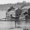 |
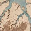 |
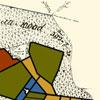 |
 |
 |
 |
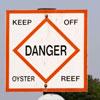 |
 |
Making Sense of Maps
This site from History Matters explores how to use maps as a historical source including what questions students should ask and how maps can clarify and distort the way we see the world.
Lewis and Clark: Same Place, Different Perspectives
History teacher Shanne Bowie reviews a history and geography lesson from National Geographic that investigates the relationship between history and geography.
Primary ICT
In this video, teacher Simon Botten demonstrates how to use a whiteboard to engage elementary-age students in history and geography.
Comments
Response to tmartin
I just finished my Civil War unit and wish I had done this module earlier! I agree with you on your ideas. I will definitely lead with this next year.
Since we have had so many
Since we have had so many snow days, we are behind and will begin the civil war next week. I feel the video on the civil war in this module can help students understand why so much of the civil war takes place in VA. For the most part they understand it is close to the divide between north and south, but his explanations make the viewer consider how transportation and agriculture would also play a significant role in why Virginia was so important to the war.
Love looking at others ideas.
Love looking at others ideas.
Several good ideas to tweak
Several good ideas to tweak and perhaps use while studying VA geography.
Geography
The Geographical impact of Virginia is unreal. We discuss this throughout our study of VA US History. Geography is covered in EOC US SOL's almost in every facet of history all 15 testable materials. I enjoyed the presentation of this, and wish that others could see the impact Geography has on daily life. A local county was the "Trumpiest" County in the United States. Buchanan County's livelihood is made by coal mining, after a perceived "War on Coal" by Democrats, and President Obama's policy, Trump carried Buchanan County something like 95% in a County that has been historically Democratic. The Geography won't allow for new industry, or school consolidation. The Geography, has lead to a displacement of population, and an economic impact, on the West side of Roanoke.
I'm not a history teacher but
I'm not a history teacher but the intersection of history and geography is even more important than I realized. I saw them as completely different units of study before.
I agree with your comment,
I agree with your comment, but after seeing so many connections made throughout the module between geography and its impact on history, it is hard not to see the connections everywhere now. :)
AngieB's diary idea
I love the idea to have the students create a diary where they are being George Washington and talking to members of their family from other regions. Great idea!
George Washington Diary
This would be an awesome way to integrate writing into this part of the curriculum!
Great ideas!
I love everyones ideas, especially the one with the various field trips to additional places in Virginia's regions.
Module 2
I like the post by the Middle School teacher who focuses on Land and Human Interactions because he plans to introduce lessons with maps.
Virginia geography
I like the idea of the diary and writing about the land as seen through the eyes of another person. I think I might incorporate that but have it done through the eyes of the settlers. I'd like the students to compare maps and do research first and then write from a first person point of view of what they see and how they interact with the new geography.
Response
I love the idea of the students writing about Virginia's geography through a first person point of view. I love to combine Language Arts with other content areas as much as possible.
US History I
Geography seems to impact so much on all History. I would take each unit that I introduce and make sure that I include all aspects of geography in the lesson. For example, when I teach the different Native American tribes I would have maps to interpret how the land dominated and shaped their lifestyles.
Interpret primary sources to have students match the tribe with the resource. Have them write a summary to tie the matching game with the resources in the geography of that region.
I also liked the idea of comparing a map of Jamestown in 1607 vs a map of Jamestown today.
Compare and contrast the two maps. What created the changes?
The different sources made me more aware of just how important Geography to History.
Civil War
I loved the ideas about teaching the Civil War and the specific battles and how railroads had so much impact.
Response
I also really loved the idea of teaching the Civil War and the battles and how railroads impacted the battles.
Civil War
I agree with your comment. It was interesting to hear how the battles occurred where they did because of the Virginia's geography.
Regions
Although I've already taught these lessons without using this learning experience, I am excited that I will be able to review the same material using a different strategy that will engage my students even more.
Virginia yesterday and today
I would begin teaching with showing types of maps of our regions explaining that they themselves have not changed. I would also see field trips to the mountain area and then to coastal areas would help visually see the difference. I would hope to also do a salt map/plaster model of Virginia. Analyzing each area for its benefits advantages. I think you would need to apply some thoughts on how population.
Regions of VA
I agree with Donna, I would have students analyze each region for benefits and I would add the disadvantages. I would also compare why these regions were attractive 400 years ago vs why they are today.
Virginia Geography Reflection
This module has reminded me of how important geography is to history. During battles and wars that occurred in Virginia, strategy was a staple of gaining an advantage over the enemy. Using forests and river and road routes were used to avoid enemy attacks and to plan for a counterattack later. I believe that this is where role play in a classroom can be very useful in helping students understand how geography helps shape history and how we learn and remember it.
I agree, this has given me a
I agree, this has given me a new look at using Geography in my classroom. When I used to teach USI, I used to always ask my students "why" did they do this or do that relating to the geography, because we discussed the many different geographical features of the United States. Now that I teach USII, I don't focus on the "why" as much and I need to get myself back to that.
History and Geography
I find it impossible to teach history without geography. Beyond the influence of just the physical landforms, climate and available resources, there is the cultural aspects that show how and why people settled a region and the development of settlement patterns, culture and customs.
Primary Sources
This module helped to establish how important geography is and why students need a tangible representation to see how Virginia's geography has changed from when American Indians lived here, to the arrival of European Settlers, to the current state in which we live.
Response
What I took away from Module 1 was the importance of students having hands on experience with primary resources, helping them to think critically.
Geography
I like the Idea of the diary writing based on living in Northern Virginia compared to living in a PLACE like Roanoke or Norfolk.
Several Good Lesson Ideas
There were several good lesson ideas posted here. One I especially liked was applying the study of maps to the Roman Empire. I could definitely implement this in my World History curriculum, as my students often struggle with the geographic aspects of Roman history. Thanks for sharing!
connecting geography with history
I've neglected to think of how geography can help us think historically. I especially like the idea of using old maps as a primary source asking students to think about what the map can tell us about it's intended audience and author.
Geography IS SUPER IMPORTANT!
I enjoyed jhudson's comment on using geography in the Civil War Unit and it could also be used in the American Revolution unit; especially since George Washington had been a surveyor before he became the Commander-in-Chief of the Continental Army. Also I strongly agree with amcmillen comments.
Great Ideas for using maps in the classroom
I enjoyed reading the different uses of maps to help students understand the connection between geography and history. I plan to use several of these ideas in my classroom.
Maps!
Yes! Kids love to use maps today...we look at old maps and then use Google maps to compare. They think is is fun.
Whoa! Lots of great ideas for
Whoa! Lots of great ideas for the High School level of teaching Virginia history and government. I will definitely be thumbing back through these to help create lessons for my classes!
Great Ideas to help learnig
One teacher mentioned starting each unit with a picture or image to initiate discussion. I would like to try that as well. Another idea I liked was decorated an area of the room to match a region of Virginia.
Pctures
I really thought that this idea was amazing as well. My youngest son has a processing disorder, and pictures/visuals really assist him in retaining information. He had a hearing impairment that was corrected when he was three, so he depends greatly on his capability as a visual learner. I think presenting the picture, kind of like the fence in this module, would help learners like him. The fence would make him remember the conflict over territory.
Starting with a picture/image
I think this is a great idea! I thought about this as well when they mentioned comparing maps. It would help to make sure that geography language and those details are front loaded in students' minds before beginning to get into the unit...and then could be referenced throughout to tie in geography to the discussion of various topics within the unit.
Virginia Geography
The comments just reinforce, to me, the importance of Virginia in the history of the U.S. We have such a variety of people with a great difference in physical geography from east to west. The geography in Virginia has greatly influenced the state economically and socially.
Return to Rethinking about Geography
After reading other people's way of thinking, I would add some more graphic organizers into my way of teaching about Virginia's geography. Students should have a fluid understanding of maps, geography, and landscapes. This all can be made possible through the techniques, strategies, and skills in how we teach students.
Creating an teaching environment for students to love to learn in creates a lifelong love for what you are teaching. If we show our passion for what we are teaching by being accurate and through using many resources and sources sharing that we have researched and we know what we are teaching about the students will want to learn more and more, thus human interactions have occurred.
Awesome stuff!
Not only did I feel like each of these primary sources were amazing resources to use, I also appreciate all of your ideas and input!
Virginia Map Construction
@JohnPaulJ, I think your project will be really neat. I know a certain Third Grade teacher that would most definitely be interested in helping out with that project. I think the cross-curricular connections made between Art and the content areas truly help students to understand concepts.
What can we do with a river? Roman Empire
Everyone had great suggestions about how to incorporate geography in with their history lessons. Because there are so many cities (especially on the east coast) that grew up around rivers, I think the lesson, "What can we do with a river?" allows students to explore what characteristics all these cities had in common and how geography was the key factor. I also thought discussing about why the Roman Empire was located where it was was a great way to include geography in with World History.
Reply to DeannaC
As we know from World History I, rivers were very important- "Early River Civilizations" certainly benefitted. Not only were they useful for transportation and fertilizing soil, like the Nile River, they were also used as natural borders, as in your Roman Empire example. The Rhine and Danube Rivers offered protection from Germanic and Central Asian tribes, at least for a while. Virginia, with the James and Potomac Rivers especially, has eastward flowing rivers that helped settlers get deep into the interior, but also get goods to foreign ports as they emptied into the Chesapeake Bay/Atlantic Ocean. This is a great advantage America has over a country like Russia, which has few rivers flowing into trade routes. We have lots of rivers that get to the coasts from the interior. The Mississippi River is probably the most important, given its length and the number of tributaries it has. In my history classes, I always incorporate geography as a way of demonstrating that "geography is destiny."
Voting Map Idea from Zford
I love this overlay of geographic areas and voting demographics. You could have a lot of discussion about political platforms and having students describe why one population from an area might choose either party based on what is in the platform that benefits them. Then you could even go farther by asking them about "safe districts" where one party always gets a majority of the vote and challenge them to try to redraw districts without gerrymandering or to gerrymander so they see how that works.
In response to Holly Natalie
I love your idea of showing a map in the European's point of view and the Powhatan's point of view and discuss the differences and things that may have been important to each group.
Geography and European Exploration
In addition to World Geography, I also teach World History. It is always interesting to watch students realize that the Europeans initial desire for gold and riches was quickly redirected to harvesting a different type of riches.
Teacher, World Connections
I thought that the ideas presented were similar to mine in that they deal with teaching students how our geography influences our connections with the rest of the globe. Good ideas.
Geography in USII
I have enjoyed reading the ideas of all of my colleagues. One way to incorporate the geographic theme of movement would be to tie in the push/pull factors involved in Western Expansion and Immigration.
How History is Affected by Geography (Tiffany Smith)
Like you I didn't really understand why we started history the way we do. I too understand now.
Mental Map Exercise
I like this idea. It gives insight into what's important to them. Also how they think or feel about certain areas within the city/community/region.
Cross Curricular Teaching - Music and Art with Geography
It was awesome to see some perspective from the music and art standpoint! I think connecting geography to those concepts would really hook some of my musical and artistic learners. Thanks for sharing!
Connections Between Topography, Settlement, and Regional Culture
In many of the lessons described above, I noticed a common thread. Across the state, all teachers must teach the regions within state guidelines. Demonstrating a connection between the physical landscape and the settlements which developed on them is a key component of this information.
Beyond this requirement, however, many teachers are also tying in local physical features and unique local history to make this concept especially relevant to their students. I think this type of extension beyond the state standards is so important. Students should also understand local history, and how their unique area fits into the larger context of Virginia.
Pages